|
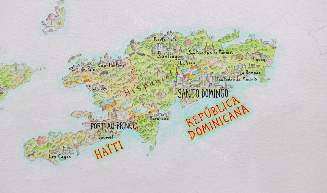
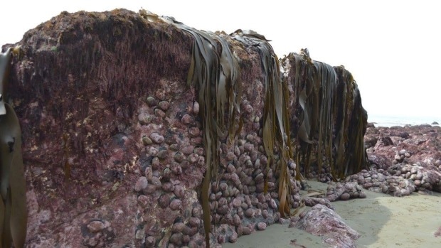
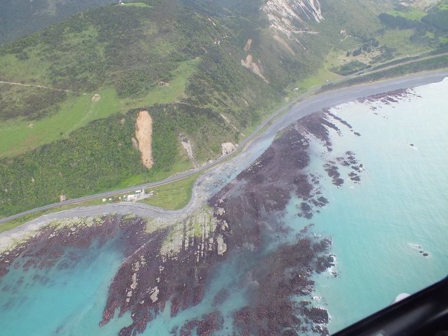
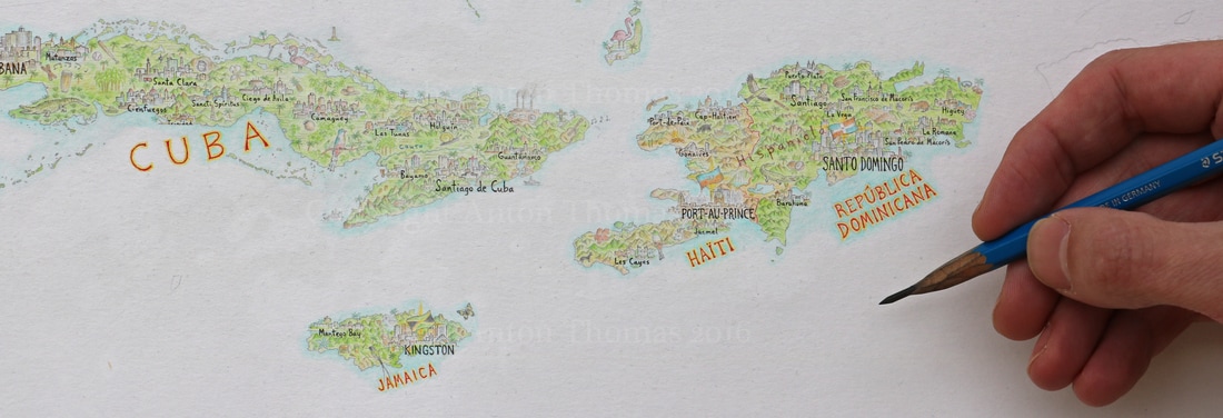
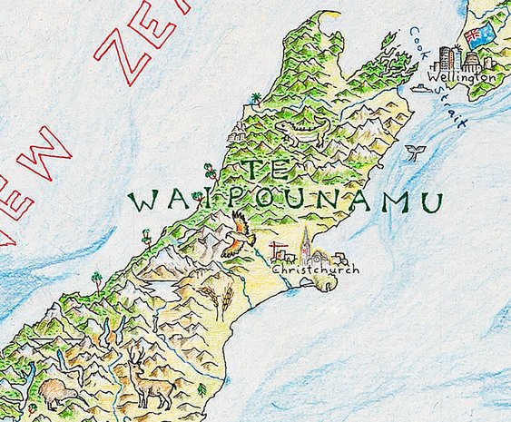
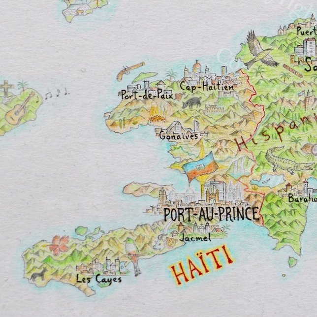
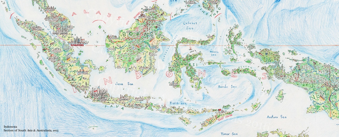
Destructive forces lie at the very heart of this world. Drawing Haiti was a reminder of the many challenges associated with depicting trauma. This blog discusses the nature of these challenges, with focus on two forces familiar to Haiti - earthquakes and fire. A few months ago, while preparing a commentary on drawing Haiti, a huge 7.8 earthquake rocked the centre of New Zealand. The most powerful quake to hit my home country in nearly a century, it was a reminder that geography is a story of upheaval and change. Mountains cracked and heaved, pulling hundreds of kilometres of coastline straight out of the ocean - along with vast stretches of submarine rock. This new shoreline, birthed in seconds, left immense reserves of shellfish to rot in the sun while landslides smashed a hole in our main national highway. All the lower North and upper South Islands were shaken, including both my hometowns, leaving rattled nerves and condemned buildings. Fortunately, the timing and location led to only two casualties, but the destructive power was breathtaking. I live in Australia now, a continent of seismic calm, but talking to friends and family while watching pictures and analysis come in – it left me considering something wider than the overview I was writing about Haiti. This world would be unrecognisable without destruction and trauma. So, what of trauma in cartography? Having just drawn earthquake-shattered Haiti around the time of the quake, I’d been considering this question a lot. Devoting a blog to it seemed appropriate, with particular focus on two traumatic forces that play a role in Haiti: fire and earthquakes. Today I will present several examples in my work where I’ve grappled with this problem, and offer thoughts on the traumatic nature of geography and how we might discuss it. So first, why does this present a challenge at all? Trauma is not evenly spread around the world. Some countries suffer earthquakes, others don’t. Some burn, some flood, some freeze. These earthly forces are interwoven with the story of civilization, which too has a profound imbalance of pain: prosperity uplifts some, while poverty restrains others. This can present unique challenges for cartographers, not least those making pictorial maps. When we choose to display trauma while elsewhere beauty flourishes, might this harden existing notions of despair? Focusing on the beauty of the world is compelling, not merely because we want maps and art to be beautiful, but because cartography is critical in how the world is viewed. Acknowledging trauma can deepen shadows that already depress places and people that deserve the dignity of beauty. But life is not utopia. Rather than decorate the world, I’d like to engage with it. First and foremost a cartographer relies on data, and data has a way of encouraging complexity. In creating pictorial maps, the temptation to focus solely on idealistic content is strong. However, beauty is not a matter of good or bad. Truth has a beauty that tells a more interesting and relatable story than any utopia. Even in regions with far more wealth than Haiti I have irritated locals (who are justified in feeling this way) - by drawing smog-belching factories, open-pit mines and grim oil refineries. In parts of Mexico ravaged by cartels I’ve drawn assault rifles and opium poppies. Prince William Sound in Alaska has the sinking Exxon Valdez spilling oil through its waters. In Bhopal, India, I left the cityscape entirely without colour to emphasise the toxic legacy of the Union Carbide disaster. These are reminders of real pain, and I don’t blame residents of such areas if they dislike my depiction. No one wants their home defined by trauma. After all, we connect with our land through much more than a lens of despair and disaster. Yet we’re also unlikely to view it as a sunny brochure of attractions and regional iconography. Some places are impossible to imagine without the changes brought on from recent trauma. Port-au-Prince, Haiti is one of those places. 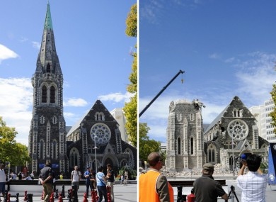 ChristChurch cathedral before and after 2011's devastating quake. ChristChurch cathedral before and after 2011's devastating quake. To draw this shattered city, I settled on a method I used back in my South Asia/Australasia map. Christchurch, New Zealand, was devastated by a violent 6.3 in February 2011. 185 people died as many buildings in the city collapsed, huge boulders barrelled down the hills, and liquefaction turned concrete to slush. The most iconic landmark and symbol of the city, the ChristChurch Cathedral, was toppled. As is the case with symbols, its destruction was symbolic too - the crumbled church came to symbolise an earthquake that changed a city forever. I drew it lightly with a faint aura to make it somewhat ghostly, but ensured it was as prominent as if the building were still standing. A crane rising from the broken skyline symbolises the rebuild, while the deference paid to the cathedral is to respect both trauma and the spirit. Hard copy maps will always be time stamps. Borders change, forests burn, new landmarks are built while old ones crumble. Port-au-Prince, like Christchurch, required addressing an earthquake that stripped it of landmarks and thus much of its identity. As the imbalance of trauma in the human story is pervasive in Haiti, their quake was much more deadly. On January 12, 2010, a shallow 7.0 struck Port-au-Prince. Centred only 25km west of the city, it turned dense hillside slums into landslides of rubble and bodies, as up to 70% of the buildings in the city collapsed. The final death toll will never be known, but estimates run as high as 200,000. Among the deadliest quakes in recorded history, it will take much more than seven years for its terrible legacy to abate. It was the confluence of many other traumas that made the earthquake so especially deadly. The poorest country in all the Americas, it has suffered a long history of political instability and unrest. This turmoil at the top has played no small role in another example of physical trauma - and one equally unavoidable in cartographic depiction. In less than a century, the large majority of its forests have been burned and felled, wreaking havoc. Rivers are either dry or flooding, topsoil has made way for bedrock, and the northwest is now home to the largest desert in the Caribbean. Less than 2% of its original forests remain, with only a small pocket to be found at Pic Macaya in the far west. The Dominican Republic, Haiti’s wealthier, healthier neighbour to the east, has had a very different history with deforestation. The border they share is one of the most disparate in the world. Matching exactly what one can see from space, I’ve ensured the colours on each side make this clear. 60% of Haiti's energy comes from coal. This is central to the loss of forest, so I have drawn burning coal in the northwest at the site of this largest Caribbean desert. Fire in art evokes motion, and wherever phenomena are of a fiery nature their inclusion can be highly effective in a map. From erupting volcanoes to gas flares on oil refineries, fire always makes for visceral content. Even satellite pictures of the Earth at night tell us profound things about human geography via a network of blazing lights. In a previous map, South Asia & Australasia, I drew two examples of burning forest. Throughout Indonesia, sections of tropical rainforest are up in walls of flames. Suffering the most rapid loss of tropical rainforest in the world, islands like Borneo and Sumatra endure a contemporary trauma central to its geography. This is catastrophic not just for Indonesia. Its haze-cloaked neighbours suffer, while the wider world, with its eroding biodiversity, cannot afford such losses. A postcard-perfect pictorial map of these regions is tempting, as orang-utans and rhinoceros thriving in the jungle make for superb content. But perhaps we’ll care more for these precious fauna when the precariousness of their situation is highlighted. 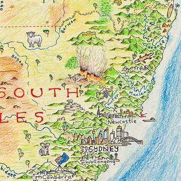 The other example on this map was also burning forest, but with a completely different context - bushfires in Australia. While flames are for the first time searing the inner reaches of Borneo’s rainforests, fire has long been essential to the lifecycle of the Australian bush. Indeed, many species of Eucalypts require burning to reproduce. The event is no less traumatic for those at its mercy, as Melbourne’s 2009 Black Saturday fires sadly remind us, but it is in harmony with the Australian biome. So, even within the same phenomena, the opacity of trauma and the diversity of geography present very different tales. As the eucalypt tells us, fire is rebirth. As the tropical hardwood tells us, fire is destruction. Avoiding trauma in geography is to avoid the very forces that shape our world. Acknowledging this is critical in my view; even if it may remind some of very real hardship and danger.
4 Comments
Sue Smales
2/24/2017 03:51:19 pm
A fascinating angle Anton.
Reply
2/24/2017 04:12:46 pm
Anton. Beautifully and empathetically articulated. In your words and your art I love the unapologetically subtle and constructively provocative but inoffensive way you blend your very personal but honest and obviously passionate opinions with topographical fact. Not everyone will share your viewpoint, but no-one should be offended by your interpretation and balanced argument. The artistry in your map work is inspirational. The translation of your art into a lesson on the geography, history and social politics of, and current and traumatic natural events impacting the regions on which you have focused is both intensely interesting and highly educational. Well done.
Reply
Bill
2/24/2017 04:59:43 pm
Wonderful clarity and clever perceptual analysis. Thought provoking stimulating!
Reply
5/14/2022 02:01:44 am
All the lower North and upper South Islands were shaken, including both my hometowns, leaving rattled nerves and condemned buildings. Thank you for taking the time to write a great post!
Reply
Your comment will be posted after it is approved.
Leave a Reply. |
Interested in press, wholesale, or anything else? Email us at [email protected]
Copyright © 2024 Anton Thomas Art. All rights Reserved.
 RSS Feed
