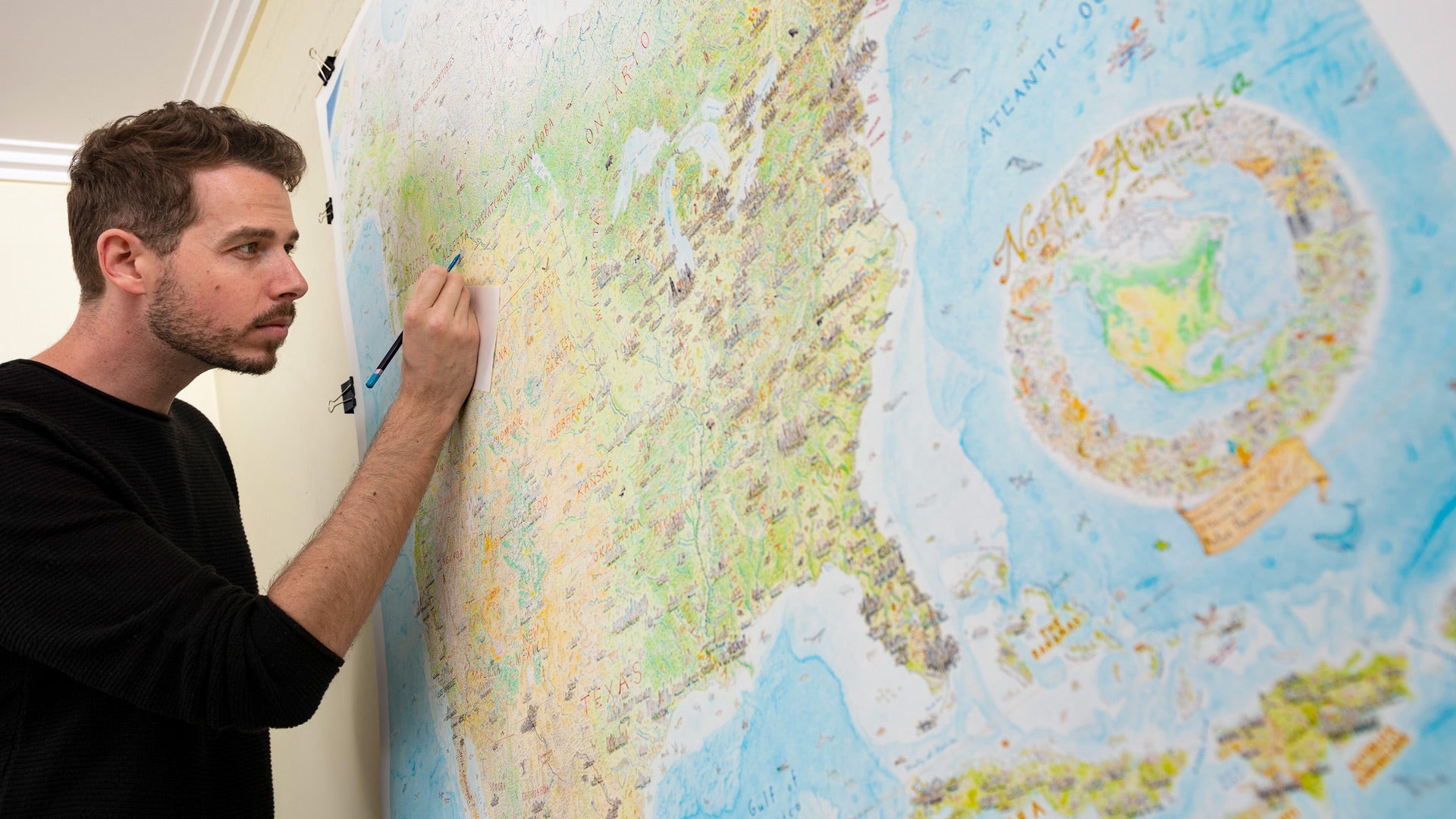
Glacier National Park, Montana. In September 2017, I took a trip to one of America's most beloved and beautiful national parks. As a Kiwi I am no stranger to spectacular scenery, but this pristine stretch of the Rockies was unlike anything I’ve ever seen. Arriving in East Glacier with some good friends from Missoula, we enjoyed two unforgettable days in a land of moose and bear. With the largest population of grizzlies in the contiguous 48, Glacier is a realm in which us humans are not the apex predators. Denied our usual command of nature, one must be as alert as deer in this house of bears. There were many moments on the snowy hike up to Grinnell Glacier that I cherish, not least bumping into a solitary grizzly mere feet from the trail. It was one of the tensest moments of my life, but thankfully the bear kept its distance before lumbering across the trail into the woods. I felt supercharged for days after the encounter. Perhaps occasionally crossing out “don’t get eaten” from your to-do list is good for you. I highly recommend it, but only if the task can be completed. We got within metres of a curious mountain goat, only to watch it disappear over a cliff like a superhero once it was tired of us. I ran to the edge and saw the goat bounding along the sheer rock face with ease. The next day, driving Going-to-the-Sun Road, we spotted a mama grizzly with her cub not far up the hill. She raised her snout and sniffed the air in our direction, before breaking into a run and disappearing over the rise. It was another reminder that in western Montana, nature reigns supreme. So much was memorable about my week in Montana, with moments like these only the tip of the iceberg. When I returned to Australia after this 2017 trip to the US, I resumed work on The North American Continent. It was lined up so the first place I’d draw upon returning home was none other than the Crown of the Continent: Glacier National Park. There’s a fair bit drawn around Glacier. Chief Mountain, St Mary Lake, Wild Goose Island, Bird Woman Falls, a grizzly in Bob Marshall wilderness, an ascendant mountain goat, a marmot (aka “whistle pig”), the Prince of Wales Hotel just over in Waterton. In particular I wished to include a crown, referencing the widely used “crown of the continent” phrase that describes this near-pristine ecosystem. Question was, where in the park should the crown sit? Where is the head upon which a crown deserves to be placed? At first I thought Mt Cleveland made sense, being the highest peak in Glacier NP. Still, it seemed a shallow interpretation of the crown. It isn’t even the tallest peak in Montana, and a mere high point does not reflect the sort of mystic deference evoked with the phrase “crown of the continent”. Then, I remembered somewhere that does. A mountain that was pointed out to me while we were there: Triple Divide Peak. Triple Divide is a totally unique phenomenon. On this one peak, water clearly flows to three different oceans: the Pacific, the Atlantic, and the Arctic. This is the only such triple divide in the world, and is thus the hydrological apex of the North American continent. This is where a crown should sit. A single peak where the oceans encircling a continent come together as one. I wanted to ensure my map shows this triple divide clearly, so one can trace the water all the way to each ocean. I love the idea of people following rivers with their fingers like one follows a maze. On the west side, waters flow into the Flathead, the Pend-Oreille, the mighty Columbia, and finally the Pacific Ocean. On the east side, waters flow to the Marias, which flows into the Missouri, Mississippi, and finally the Gulf of Mexico. To the north, water flows into St Mary Lake, which feeds the St Mary River, the Saskatchewan watershed, Lake Winnipeg, the Nelson River, and finally the Arctic Ocean via Hudson Bay. All three can be traced from the Triple Divide crown. Now, there’s a slight wrinkle here, demonstrated in the next image. Hudson Bay, source of Triple Divide's Arctic destination, can be easily argued as a marginal sea of the Atlantic. Its widest outlet, the Hudson Strait, feeds the Labrador Sea. When using this definition, Triple Divide does not technically feed three oceans. I get it, but I feel Hudson Bay might as well be Arctic for the purpose of an epic divide. Along with its northern positioning and frozen waters, the Foxe Basin (the bay’s northern arm) flows into the Arctic Ocean proper via the Fury and Hecla Strait. These, among other reasons, are part of why Hudson Bay is so often classified as an Arctic body of water. And even if you feel strongly that the bay is Atlantic and thus disqualifies Triple Divide - not to worry! North America has you covered. A few hundred miles up the Rockies is Snow Dome, on the BC/Alberta border. The glacier that caps Snow Dome sends water to the Pacific via the Columbia River, the Arctic Ocean proper via the Athabasca and Mackenzie basins, and Hudson Bay via the North Saskatchewan. Upon learning about Snow Dome, I was suddenly very curious. I put conscious effort into ensuring that my drawing of Montana's Triple Divide shows three watersheds clearly meeting at the peak. Yet the area around Snow Dome was drawn months ago, before I knew Earth even had such a divide. If I cast my eyes up to where Snow Dome should sit, will I see the triple divide on my own map? I located the peak, referenced it against my map, and to my astonishment the answer was yes. The Columbia Icefield, where Snow Dome is, quite clearly sends water in three different directions. I stood there in my studio fascinated. A mountain that sends water to three oceans is insane. There’s a reason there’s only one occurrence in the world (or to be more exact, there are two but they’re mutually exclusive); the chances of this happening are slim. The only other continent bordering three oceans is Asia, and it’s so vast that the Arctic watersheds get nowhere near those of the Indian Ocean. So I was excited to notice I had drawn a triple divide at Snow Dome, Canada. A fascinating piece of content was unconsciously drawn just by following the rivers. To puzzle over whether Hudson Bay is Arctic or Atlantic distracts from the clear fact that Montana’s Triple Divide Peak is the greatest of Earth’s hydrological divides.
After all, the naming and delineation of our oceans is hardly a science. And any divide that excludes the Mississippi basin (as Snow Dome does) is hardly the hydrological apex of North America. In Montana, and Montana alone, water that will flow through Arctic tundra meets those that feed the steaming swamps of Louisiana, and those that cut through the Cascades and into the mighty Pacific. Triple Divide Peak is a crowning moment in the geography of not just North America, but the entire planet.
4 Comments
|