Maps by Anton Thomas
  • Home
  • Shop
  • Story
  • Wild World
  • N. America
  • Videos

Blog

New maps and new mountains

1/4/2020

0 Comments

 
This is a reflection on 2019, following on from the previous entry, How do you finish a map?, which concerns the early months of the year – drawing the cartouche, finishing the map, and getting the piece scanned. This moves deeper into a year that had constant twists and turns... from Tokyo to Tacoma, natural science illustrators to The Washington Post.
Picture
Watching the sun rise from the summit of Mt Fuji, after the International Cartographic Conference in Tokyo in July.

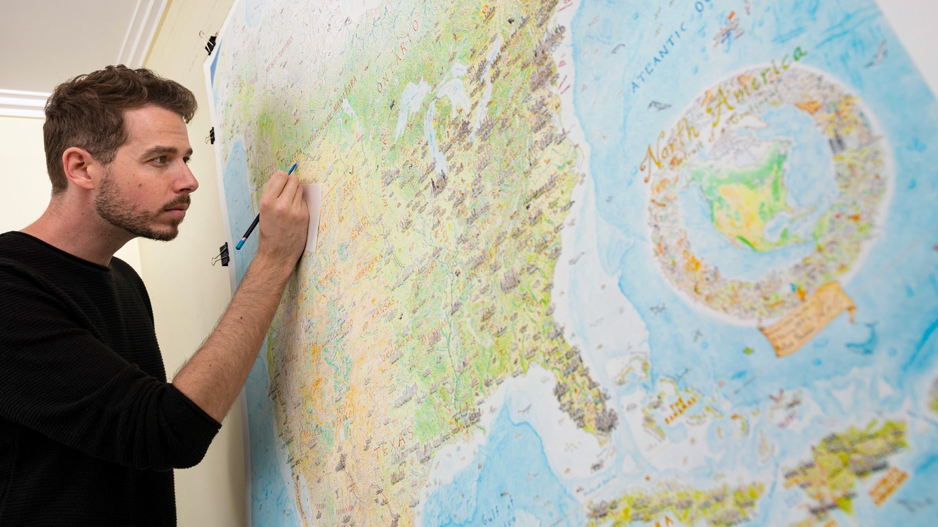
So by April, the artwork was finished and digitized. All that was left was to determine how to print and sell a huge oversize hand-drawn map of North America, while based in Australia, having never done anything like it. The way forward was not immediately clear.
Picture
A selection of test prints and strips gathered on my dining table at home.
First I had to restructure my life after half a decade where “draw the map” was the only task on the to-do list. Through April and May, I dived into all I’d need to know for the release. Many friends and professionals gave me invaluable advice, and the internet is a Godlike oracle you can ask any question of. Nonetheless, actual decisions are always up to you. You must ask questions, do your homework, then use that landscape of understanding to forge your own path.

You may meander while determining what to do. Sometimes you'll research a topic deeply until coming to a dead end, only to find it's merely a cul-de-sac that enriches your knowledge. I wrote three separate Kickstarter scripts before deciding not to launch a Kickstarter at all. Meanwhile I spent a lot of time exploring a framing solution, before deciding not to offer framing directly. But through those inquiries I learned about crowdfunding, videography and framing – all important topics.
Emoji map of the United States
The only map I made between February and June was a tweet. An emoji map of the Lower 48.(@AntonThomasMaps)

Contract work for The Washington Post

So I had plenty to do. But life goes on, and other opportunities came knocking mid-year.
​
In April, I was contracted by The Washington Post to draw a series of maps and illustrations. They had an upcoming piece about scientific locations across the Lower 48, and figured my style would be a good fit. I first engaged with WaPo in October 2018, when I gave a presentation to their maps and graphics team while visiting DC. My good friend from the carto world, the extraordinarily talented Lauren Tierney, invited me to visit the Post and I was honoured to share my map with their team. I love the work they do, and the piece sounded great, so contracting for them was an easy decision.
Picture
Four of the twelve WaPo illustrations. Clockwise from top-left: The humongous fungus in Oregon, Cinder Lake in Arizona (moon mission training ground), the Scopes Trial in Dayton TN, the Brookhaven Particle Collider on Long Island, NY.
Illustrations by Anton Thomas for The Washington Post.
Another four of the WaPo illustrations. Clockwise from top-left: the Atchafalaya swamp, Louisiana. Cahokia, Illinois. The Greenbank telescope, West Virginia. The Grand Canyon of Pennsylvania.
​So in June I picked up the colour pencils again. They’d barely had time to gather dust! The article required 12 illustrations, which were all fun to conceptualise and draw, each taking just a few hours each. But it also needed a Lower 48 base map with 12 inset closeups. This meant drawing the base map at a scale that would work for the smallest inset which (cruelly) was Delaware. Thus, the map had to be big enough for Delaware.

Using a lightbox, I set to work on drawing it. So soon after completing the insane North America odyssey, there was something almost comical about drawing another America-wide map. With every turn of coastline, every border, every mountain range, every urban area, I was like… I remember you........

But it was done in less than three weeks, I established new techniques, and I showed myself I could turn around work much faster than I'm presently known for. (Which has me excited for the maps – yes, maps plural - that 2020 may bring). You can check out the WaPo piece here, and it ran in the paper in August. And if you'd like to contact me about a commission, you can do so at the bottom of this page.
​
​
Picture
The California portion of my hand-drawn Lower 48 base map. Created by printing the chosen relief map, stapling my drafting paper to it, and tracing over the relief using a lightbox.
Picture

Guild of Natural Science Illustrators, Brisbane

​WaPo was not my only mid-year commitment. Things had stacked up through June and July and started to feel like jenga. The US-based Guild of Natural Science Illustrators were having their second ever annual conference outside of the States, up in Brisbane. Thanks to an introduction from my brilliant illustrator friend from Nat Geo (now WikiHow) Daisy Chung, I was invited to give a one-hour plenary to this new community.
Picture
Picture
The Brisbane skyline from Mt Coot-tha
The moment I delivered the WaPo artwork, I had only days to put together the talk and fly to Brisbane.

​One look at their website and I was sold. GNSI boasts many of the worlds top natural science illustrators as members, and these folks do astounding work. To be in their presence was inspiring. Until then, my professional network had been mainly with cartographers, but to hang out with science illustrators and see how they work… it was like opening a door to a room the size of a planet.

​Now, maps are a form of science illustration, of course. There is plenty of overlap between these professions. But in the carto world I don’t get many chances to discuss colour pencils and porcupines - and I spend as much time drawing animals as I do coastlines. I learned a great deal at GNSI 2019, including about Photoshop which has been critical.
While it's a US-based organisation, the conference drew many Australian illustrators. Those of us in Aussie were so grateful the GNSI made the trek across the Pacific. It was fun, inspiring, educational and delightfully quirky. The GNSI folks are amazing. It was one of my favourite weeks of the year and I was honoured to be able to speak about my work with this talented and welcoming crowd. I very much plan to go again.

A trip to Japan for the ICC

​No sooner had I returned to Melbourne than I was boarding a plane to Tokyo. I was off to attend and speak at the 29th ICC (International Cartographic Conference, of the ICA). Partly this was for the conference, but mainly it was because… Japan.
Picture
My favourite map from the Barbara Petchenik Children’s World Map Drawing Competition, a highlight of every ICA conference. "It Is All in Our Hands" by Ugne Rimkute from Lithuania, age 15.
The event was held on Odaiba, an artificial island in Tokyo Bay where you can admire Japan’s distinctly futuristic aesthetic. Wandering Odaiba takes you past dizzying loops of rail, a pretty decent Statue of Liberty, and a giant robot named Gundam Unicorn. In the gaps between Odaiba’s colossal buildings one catches glimpses of broader Tokyo, an intimidating window into the planet’s largest megacity.
​
The ICC was lots of fun, and I learned much from the talks I attended. It was also great to catch up with carto friends from around the globe and puzzle over Japan with them, while making new friends. The conference sprawled between four buildings on Odaiba, and (as any attendee knows) it rained through much of the week. Tokyo’s sweltering rainy season went late in 2019, and walking between buildings would leave you drenched in sweat and rain. The humidity was astonishing.
Picture
Shinjuku Gardens, an oasis in the heart of the megacity.
Picture
The giant robot Gundam Unicorn that every ICC 2019 attendee became quite familiar with.
​That said, Japan is so endlessly fascinating and unique, the culture so rich and cuisine so delicious, that it’s easy for one to shed any concerns and get lost in a mind-bending experience. I gave myself ample time outside of ICC to get lost in Tokyo, wandering Shinjuku and Shibuya, Akihabara and Golden Gai, stoned by the heat and oceans of people.

​After ICC, I bussed out to Mt Fuji with Igor Drecki and Toni Moore (carto friends from NZ) to summit this most storied of mountains. ​
Picture
We climbed all afternoon, past the treeline into the open heat of the scoria slopes. Up we went along this diagonal desert until we found our home for the night. The Fujisan Hotel, 3,400m (11,150 feet) above sea level. More a barracks than a hotel, we drank Asahi until retiring to bed, which was a long, shared sleeping hall where you cram body-to-body with hundreds of tired strangers all in the same predicament. I lay awake to a symphony of snoring, coughing and rustling, praying for sleep to come.

​Sleep never came, but it didn’t matter. At 2am the staff came through and woke everyone up. Due to congestion in Fuji's short climbing season, one must get on the trail before 3 for any hope of a summit sunrise. Sleep deprived and dizzy with altitude, I weaved through thousands of people trudging their way up the loose scoria, an ant-trail of headlamps zigzagging its way up Fuji in the dark.

Picture
The steep scoria slopes and baking summer heat create the sense of a diagonal desert.
Picture
A human traffic jam in the dark as the sunrise begins.
​The congestion was no joke. Coming from New Zealand I’ve never heard the word “congestion” applied to people. But there we were in the dark, thousands of us, all desperate to summit a volcano before dawn. I glanced anxiously at the eastern skies, taking shortcuts and hugging rockfaces to get past jams. A brushstroke of dark orange appeared and I picked up the pace. No longer was I tired or altitude-weary, or did I even have a past or future. All I knew was I must make the summit before the sun arrived, so I scrambled in darkness without rest.

​I finally crossed the torii gate as it was getting light, headlamps were off and those thousands of humans in the dark had faces now. Igor, Toni and I had lost each other in the madness so I found a spot alone, looking across a pink mattress of clouds from the mountaintop.

Picture
Picture
​​I watched the sun rise over Japan and it was spectacular. All the intensity of the megacity and the heat and the conference and the map duties and life itself just floated away and I was inside the sunrise.
​

We were all quite literally inside the sunrise that morning, as Fuji’s peak sat in a window between two layers of clouds. Fluffy mattresses below and heaven’s ceiling above, the sun lit both in a supernatural display.

​It was a profound moment, and all the more profound for how short it was. After a minute or two the sun disappeared above the top cloud layer, the colours faded, and a hot grey morning began. Yet I remember that minute of sunrise more than entire months in my life less eventful.
When it comes to life memories, quality has a quantity all by itself.

Coming next is a blog about the final months of the year, in which I got much closer to the goal of releasing prints, took a trip to the USA for NACIS Tacoma, and got thrashed in the rugged backcountry of New Zealand.
0 Comments

    Archives

    November 2022
    December 2020
    August 2020
    April 2020
    February 2020
    January 2020
    December 2019
    September 2018
    December 2017
    August 2017
    February 2017
    October 2016
    September 2016

    Categories

    All

    RSS Feed

Picture
  • Home
  • Shop
  • Story
  • North America Map
  • Wild World​​


  • Press
  • Videos
  • Portfolio​
  • Blog​
  • ​Contact


    Subscribe to the Newsletter:

Subscribe

Copyright © 2023 Anton Thomas Art. All rights Reserved.
  • Home
  • Shop
  • Story
  • Wild World
  • N. America
  • Videos