Maps by Anton Thomas
  • Home
  • Shop
  • Story
  • Wild World
  • N. America
  • Videos

Blog

Where on Earth is the map?

9/12/2018

2 Comments

 
It has been a long time coming, but The North American Continent is at the finish line. I'm now deciding  how to print it. So, where's it all at?
Picture
"...but I preferred reading the American landscape as we went along. Every bump, rise, and stretch in it mystified my longing."
Jack Kerouac - On The Road
It started on a refrigerator in Montréal six years ago.

For two years prior I explored the US and Canada, and a childhood love of maps was ignited to a point of no return. Geography came alive. My world was expanded as I experienced the continent of North America, a 21 year-old from an island country. New Zealand is beautiful, majestic. It is diverse and it is not small.
​
​But a continent is a continent.
Picture

Found myself living in Montreal, and it's late 2012. As the Fall progressed and the city went inside, I went inside too. My time was almost up after 2 years on this continent, and I couldn't stop thinking about the long skies. This great rolling land I'd gotten lost in, with all its mountains, deserts, plains and cities. A geographic theatre laid out like a masterpiece of heavenly proportions.

So I drew North America on a fridge. Well, most of it. And the western spine of South America. And an inset map of New Zealand, because... why not?
Anton Thomas artist cartographer
Visiting Montréal in 2017 for the NACIS conference. This was my first time with the fridge since drawing it five years prior. It's still in use.
I'm still not sure why I chose that old fridge in our Montréal apartment. It was a problematic canvas, especially as it was always filled with food, cooking happening all around it every day. The ink would run with every splash from the nearby sink. But it was the canvas I had, and everyone was cheering me on.

Since I was a kid I've had a vision of a grand piece of map art, something with endless vivid detail that you could get forever lost in. A map that would kick the door wide open for content, let in the animals, the flowers, even the sounds and smells. A map that would show every city as the unique place that it is. A map that would merge geography and art like the cartographers of old, but with the dazzling content of ​today.

So I spent a month exploring that idea on something very modern indeed... a fridge. I began my journey towards that epic map I dreamed of.
The fridge was not this map. But I never turned back.
Picture

It's 2013 and I've settled in Australia. Perth was home now, and I immediately started work on a new map. No more household appliances, this time it'd be on paper. I'd learn to use colour pencils. I'd put in some serious hours. I spent 6 months drawing South Asia & Australasia. Paying the bills as a cook in Fremantle, I set the map up in my bedroom and just... got after it. It took up most of my free time, but I loved the process. And once I finished I actually had some skills.
Picture
South Asia & Australasia (2013)

It's 2014. I've moved to Melbourne, and I'm ready to revisit the North American continent.
Picture
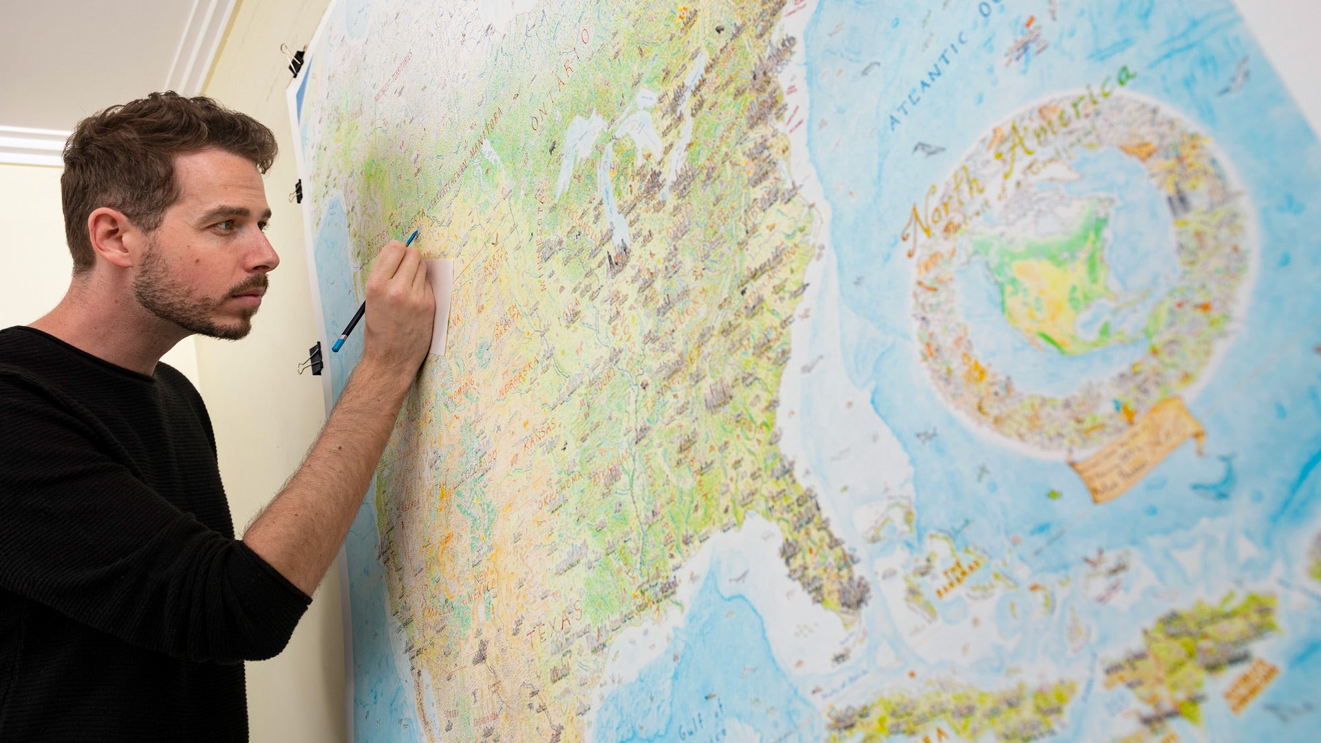
On May 5th 2014, I cut a 1200 x 1500 mm (47 x 59 inch) square of art paper from the roll and clipped it to a board. Choosing a simple cylindrical projection, I digitally projected North America to the paper and traced out the coastlines and borders in pencil.

For the next three and a half years – May 2014 to December 2017, I worked away at this map in every moment of my free time. I maintained a day-job and drew it in my nights, weekends and holidays. I lived and breathed it. It became an obsession. It was a passion project rather than a commercial enterprise, just something that I felt deeply compelled to do. I found it inspiring and stimulating, a way to explore geography in a creative way.

The map changed. The map evolved. The map got more complex. And it never seemed to end.
Finally I went full-time with it at the beginning of this year. No more day-job. But even with all the time I now have to draw, it still took most of 2018 to get it to this state, ocean and all. Even now there's about 200 hours of work left to do - mainly the title/key design, and more sea life. But that's a drop in the ocean for a project that has taken over 4000 hours.

The artwork will be completed finally by December, once I return from a 6-week trip to the States. As you might imagine, there's a lot to decide with the printing and distribution process. It's a big, finely detailed map. But I'm working on it as hard as possible, so I can get it out to the world without further delay. I hope to have prints on sale in the first quarter of 2019.
Picture
Picture

Finished all the land in May 2017, three years after starting. I felt sure the project was almost done. But the map got much more complex when I started fixing up the earliest-drawn content...
Putting thousands of hours into one hand-drawn map led to vast inconsistencies, due to technical improvement that is inevitable after all that practice. I had gotten so much better that a large swathe of the early map needed to be “touched up”... as I called it at the time. Some minor fixes, lift a few faded colours, add a bit more content.
But as I took my pencils and eraser down the west coast, this term "touch-up" became hilarious. The touch-ups were instantly a full-blown re-draw of a vast portion of the map. I had to work around so much old pen content (cities, rivers, borders, labels) that I developed a technique to scratch pen off with a scalpel. This allowed me to re-do any city that was not good enough.

I scratched off and re-drew almost 100 cities. (More on this process in my video presentation, Methods of a Hand-Drawn Map).
Picture
Picture

By the time I was done with the re-draw, I’d transformed the western half of the USA, and about a third of Canada. And… it was July 2018. 14 months after I began the “touch-ups”.
Picture
​Despite this big expansion of the workload, it was worth every second. The western region was the weak link of the map, an area with an artistic/geographic quality that was wildly inferior to all the rest. An area that many of you call home! No... couldn’t leave it like that. So I re-drew it, and now that region is the strongest work to date. And I’ve integrated these changes seamlessly into the rest of the project.

​Since then, blitzed through the ocean. I’ve drawn its bathymetry: the continental shelves, seamounts, trenches and abyssal plains of the seafloor. This, along with the re-drawn west, has transformed the map into a piece that is finally united… speaking as one. The map is so detailed that even I discover new things every time I look.
Picture
“What would an ocean be without a monster lurking in the dark? It would be like sleep without dreams.” ​
-Werner Herzog
The other element to the ocean is the marine content. There is sea life of every variety, as well as many boats and ships. To the right is a small sample of some of the sea creatures already drawn across the map. From narwhal in the Arctic, to tropical fish in Nicaragua, the oceanic content is placed where it actually lives. I already have more than 120 sea creatures on the map, with quite a few more to go.
Picture

Meanwhile, I decided to include an inset map of Hawaii in the Pacific, to complete all 50 United States. While geographically it is not part of the North American continent, its role as a US state made it an easy choice to include.
Picture
Picture

Just before I go - I'm in the USA for the next six weeks to discuss printing and distribution (if you're interested to talk feel free to email me), and to give a number of presentations about the map. I will be displaying a 1:1 print of the original at all speaking events. If you're in town, come along and say hi! The confirmed talks are as follows:
​
  • Chicago Map Society - Newberry Library. September 20, 5:30pm.
  • Norman B Leventhal Map Center - Boston Public Library. September 25, 6pm.
  • New York Map Society - The World School, Headquarters, 17th Floor, 11 East 
    26th St (between Park and Madison Avenues). October 4, 6:30pm.
  • David Rumsey Map Center, Stanford University - San Jose CA. October 24, 3pm - Free, but requires registration.
​
​
Currently working on setting some up in DC and San Francisco, so if this kind of thing is in your wheelhouse - I'd love to talk.
ABOVE: Videos of two talks I gave at NACIS 2017.
Picture

And one final important thing. I have been so moved by all of you following my progress during the four years of this maps creation. The support, the feedback, the passion, the enthusiasm for this style of geographic art... it is amazing. I feel so blessed to have people interested in this work. Thank-you to all of you who follow it, whether on social media, in person, email... all of it. I always love to hear your feedback and ideas - many of which have influenced the map over the years.

Okay, onto finishing the map!
Picture
The full map, as of September 2018. All that remains is the Southeast corner (northern coast of South America, it will be without illustrated content, same as Iceland/UK and Siberia), the deepwater bathymetry and sea creatures of the Atlantic, and the title/key design which will sit in the mid-Atlantic.
2 Comments

    Archives

    November 2022
    December 2020
    August 2020
    April 2020
    February 2020
    January 2020
    December 2019
    September 2018
    December 2017
    August 2017
    February 2017
    October 2016
    September 2016

    Categories

    All

    RSS Feed

Picture
  • Home
  • Shop
  • Story
  • North America Map
  • Wild World​​


  • Press
  • Videos
  • Portfolio​
  • Blog​
  • ​Contact


    Subscribe to the Newsletter:

Subscribe

Copyright © 2023 Anton Thomas Art. All rights Reserved.
  • Home
  • Shop
  • Story
  • Wild World
  • N. America
  • Videos