Hi everyone, It has been ages since I wrote a blog, and there's much to share. Today I'm diving into my world map of nature – exploring its themes, animals, and landscapes. I’ve been drawing Wild World for 2+ years now, which is far longer than I guessed, but I didn't expect 1,000+ animals either...
When I say I make maps full-time, some clarification: 2+ years on Wild World does not mean 2+ years of drawing. I can't draw every day. Firstly, I have a life outside of work and art... but mainly: running a business requires time and attention. Prints pay my bills, and when sales slow down, so does the art. Some months I can draw 5-7 days a week, and at other times progress grinds to halt.
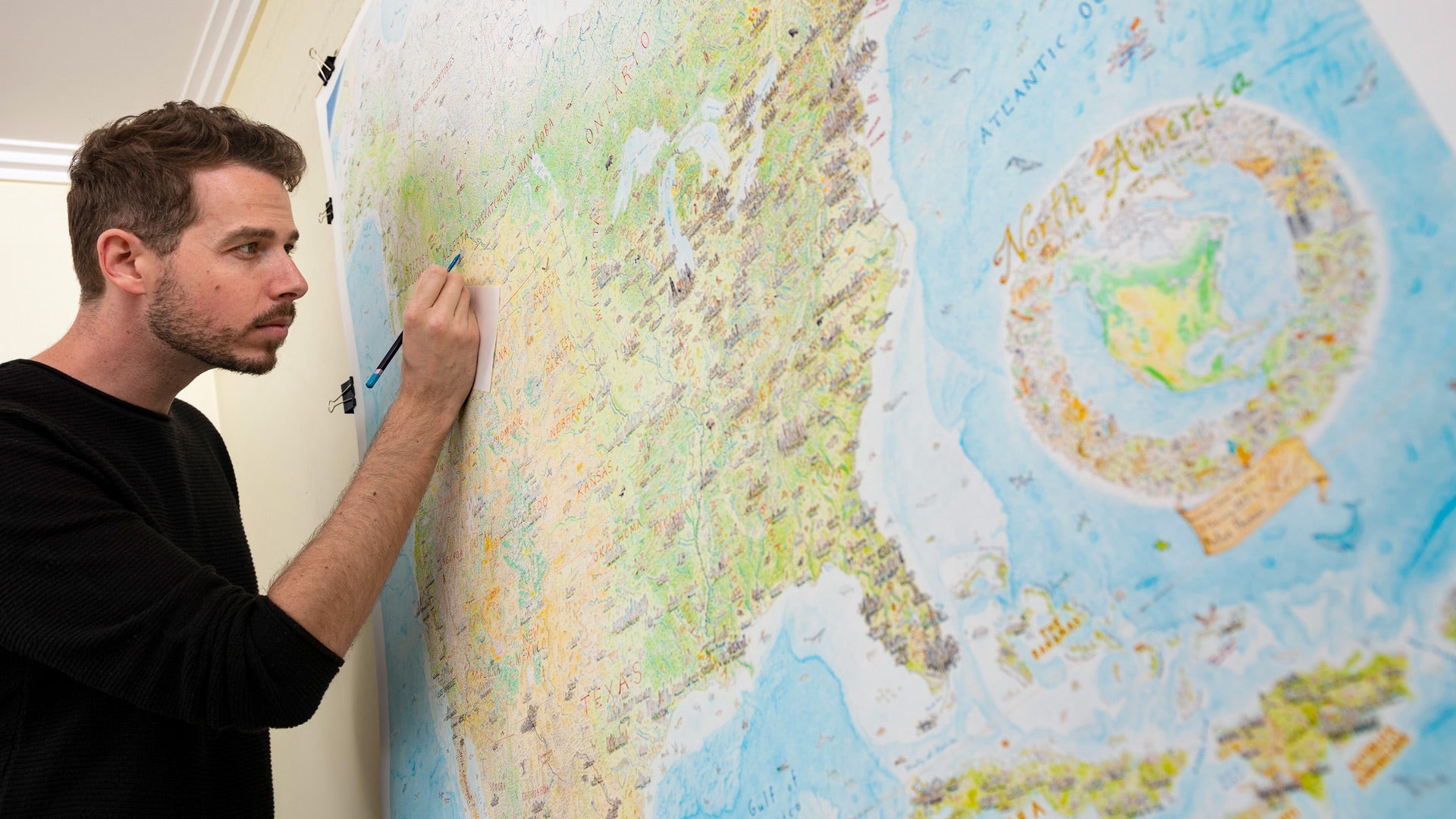
As I mentioned earlier, North America was also the most recent place drawn. Indeed, much of 2022 was spent re-drawing it. After starting there in 2020, I worked through the rest of the world. Drawing such diverse geographies transformed my style. From the Andes to the Hindu Kush, Siberia to the Pacific Ocean, I gained thousands of hours of experience. Then I looked to where I began, North America, and it was obsolete. Eclipsed in style and substance by the rest of Wild World. So just as with my last map, it was time to re-draw the early stuff. Thankfully I use pen sparingly now, so I'm not scratching ink off with a knife anymore! Here's what the map looked like initially, in 2020 (ocean drawn later): And this is it now:
In fact, most original animals were erased and re-drawn… but not all of them! Almost two dozen 2020 animals remain – look out for the mountain goat below. How are animals chosen?
Wild World: North AmericaAbove is Wild World: North America, a new print I released in November 2022. It's the second continent cropped and printed from the map, after 2021's Wild World: Australasia. These are blown up a lot from the original – showing the continents at larger scales than will be possible on most world map prints. Each region is a different size and shape however, so the scale, size, and editions vary too. Learning as I go!
Waterfalls, rock formations, flowers and trees… they all bring geography to life. They are geography. I stopped worrying about relative scale; a cougar towers above the Cascades, a quail is the size of Mt. Shasta. And why not? Always consider what one's map is for. No-one will use Wild World to plan a canoe trip or a flight path (at least I hope not). And thus my hand is free… let the Colorado River flow past Utah’s delicate arch, before disappearing into the Grand Canyon. Let the Sierra Nevada open like a window onto Yosemite Valley, beyond the shoulder of a condor. I’ve increasingly felt free while drawing this map. Partly because it has no cities or borders. But also free with the landscapes – using just a few iconic peaks to compose a mountain range – not trying to be too topographically literal. It’s a map made of moments. In the ocean, that sense of freedom continues. Amongst blue bathymetry, the land and sea divide is blurred. Coral appears next to trees. Fish swim by soaring seabirds. The map has a logic that allows for this – and why not? The land and sea divide is fuzzier than we often realise. It’s why I love drawing the ocean bathymetric: it shows archipelagos as the mountaintops they are.
Finally, let's look at the cartouche. Hand-drawn on a separate piece of paper, it was scanned and placed in the ocean with Photoshop (after shifting some marine life around): I’ve always been fond of a good cartouche; they can be amazing works of art, speaking volumes about a map, creating an emblem of the map. They're a creative place to put the basics – title, date, key, projection – whatever you think is needed. As you might expect, the final world cartouche will be quite a spectacle! Here is the (slightly more modest) cartouche from Wild World: Australasia. Final thoughts on natural geography
Of course, humanity has profound beauty and range. But, despite all our technology and creativity, nature is so much bigger. We’re merely a part of it, after all – a very impactful chapter in the story of this planet. It’s easy to view Earth as ours alone, so I love a physical world map without countries. Not as something idealistic, imagining no borders John Lennon-style. But as a very real perspective. Because borders are an invention – albeit a consequential one. From space, the world isn't carved up and colour-coded like a political map. So with Wild World, I offer a view of Earth by its nature, rather than its nations.
Back in 2020, I began drawing a map with us mostly out of the way, for once. I think this is an important perspective to consider. A foundational one. And I feel blessed I can offer my take on that perspective with Wild World. Thanks so much everyone. If you have any questions or comments, I'd love to hear them. And if you're interested in prints of Wild World: North America or Australasia, they're available here. Until next time! - Anton, November 2022
1 Comment
|