END OF YEAR SALE: ENDS SOON
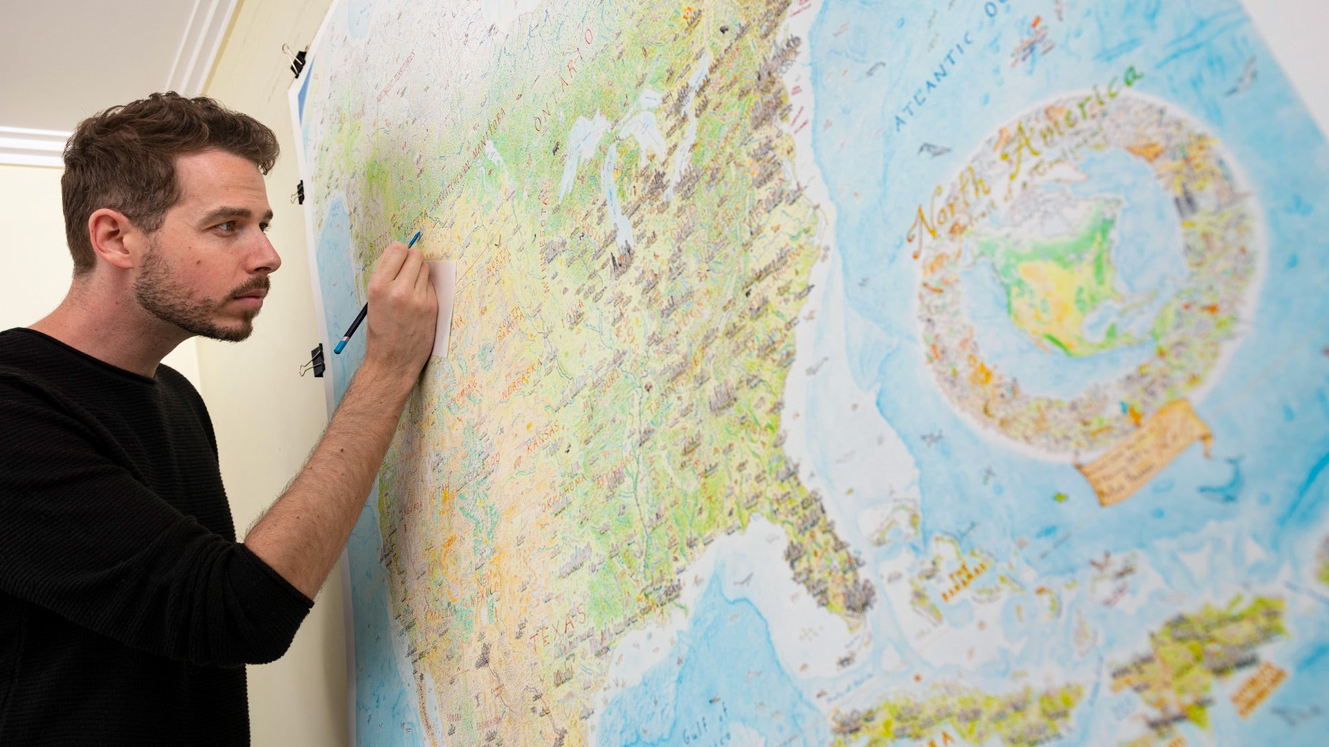
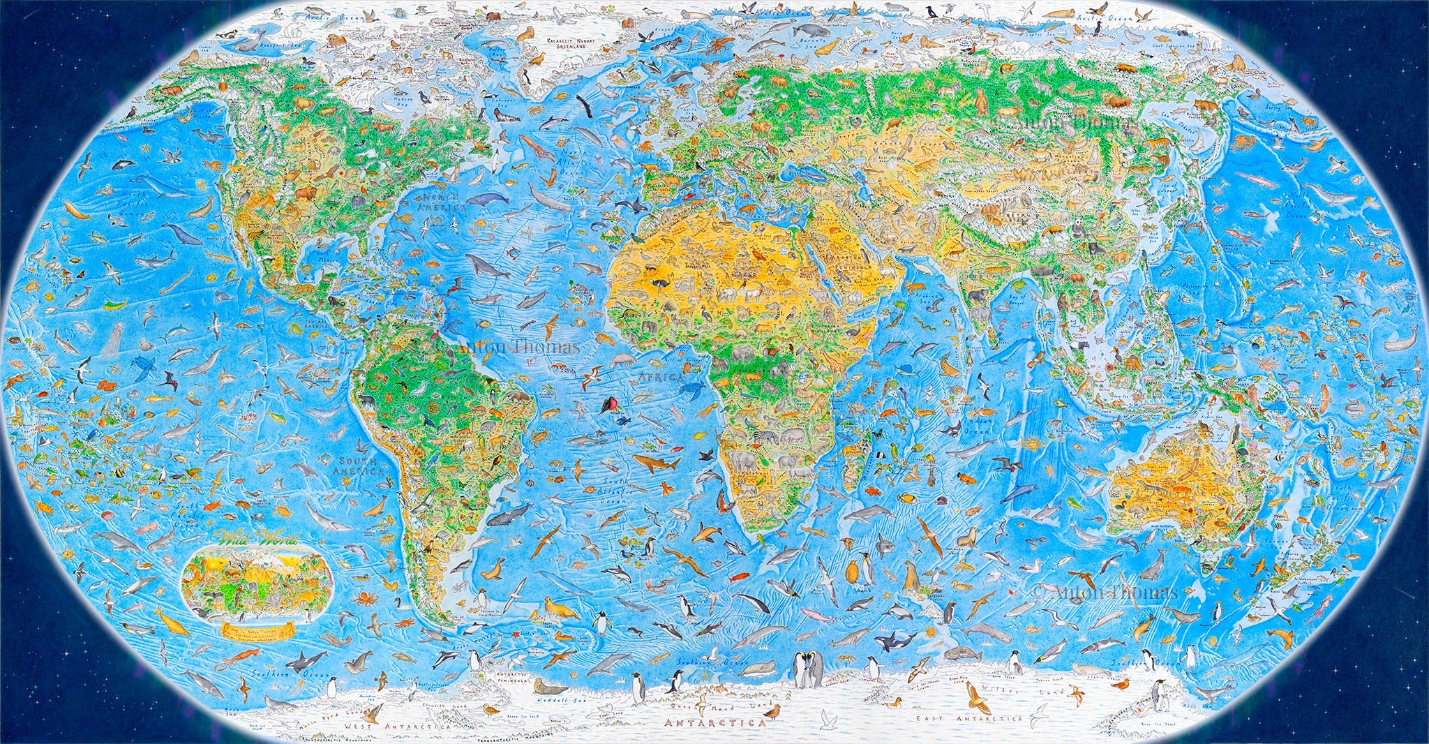
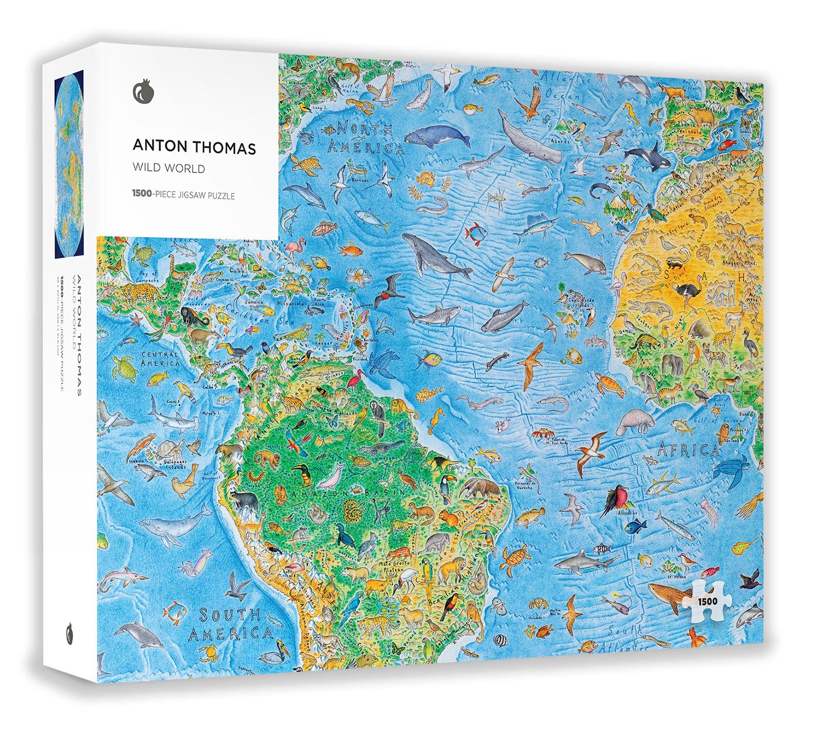
North America: Portrait of a Continent
With a vast range of details, this map of North America was hand-drawn over a 5-year period.
Spanning the entire region from Alaska to Central America, it has over 600 city skylines. It was inspired by my own travels in North America — a tribute to a continent of extraordinary variety.
As seen on


"A Remarkable Map." – National Geographic