|
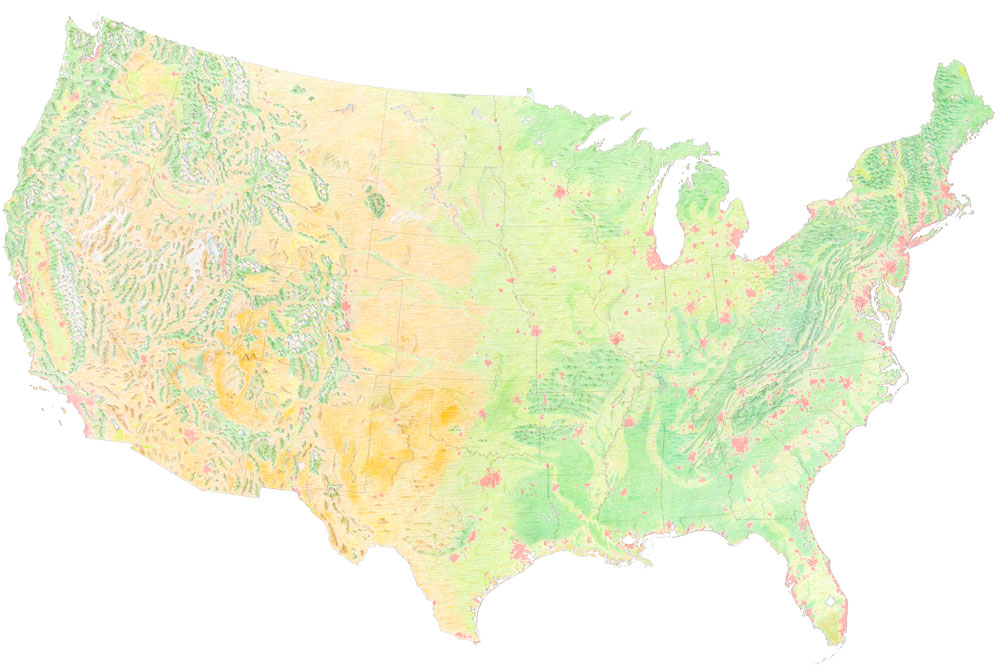
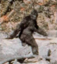
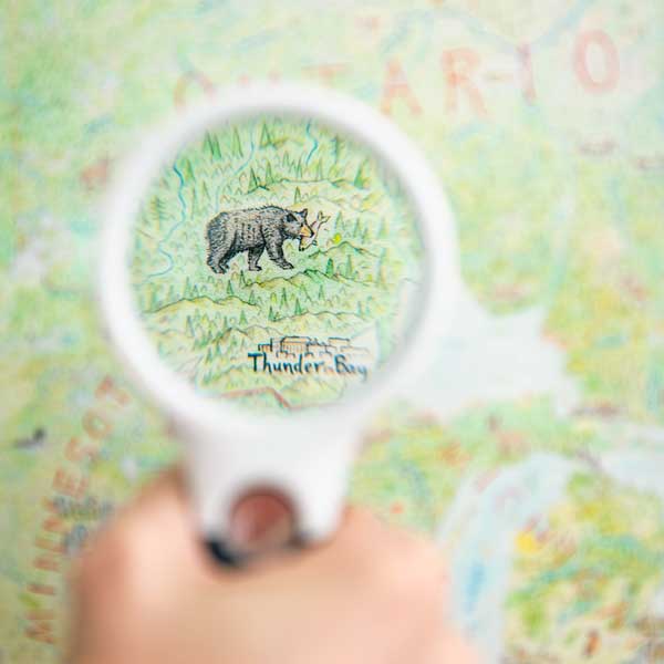
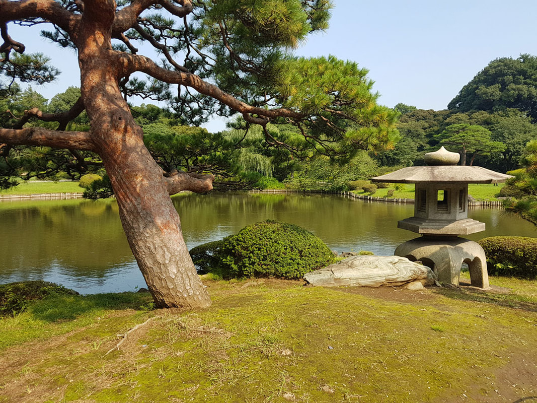
The North America map has a vast amount of detail, and sharing the countless stories it holds is important. You're welcome to ask me about its contents, and I'm working on reference tools for the prints, but I also thought - why not take a tour from time to time? So, I reopened my notebook, dived into the map, and picked 12 interesting places and cases to talk about. There is no underlying theme, just a scattershot journey across the map. So - welcome to the (first) blog tour of North America. 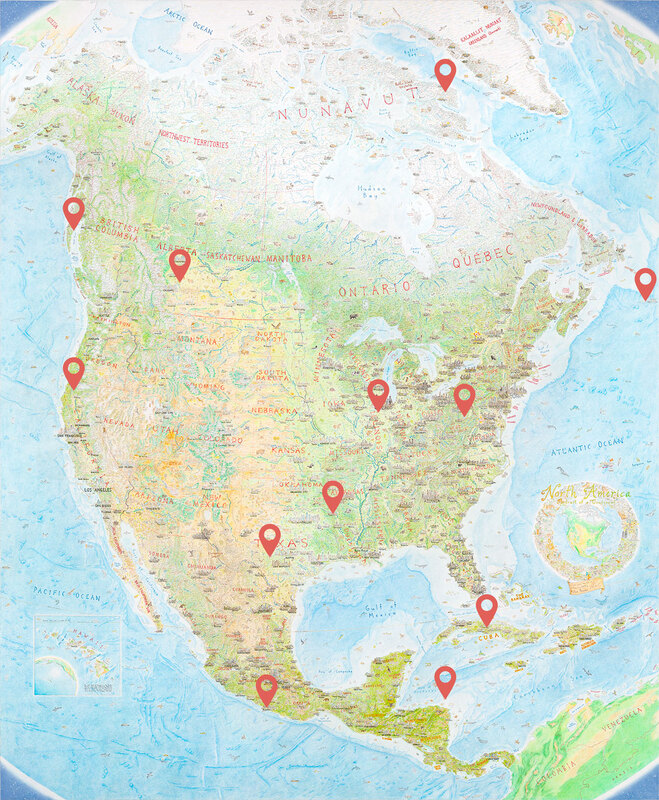 Locations of the 12 features being discussed this time. 1. The Sasquatch - Willow Creek, CaliforniaSomething does not have to be real for it to matter (not that I’m saying Bigfoot is real or not, of course...). Mythology captures our imagination in vivid ways, and local legends play a significant role in the character of place. Whether it’s Nevada’s extraterrestrial highway or a plesiosaur in the waters of Loch Ness, urban legends and mythology are well-suited to a pictorial map. 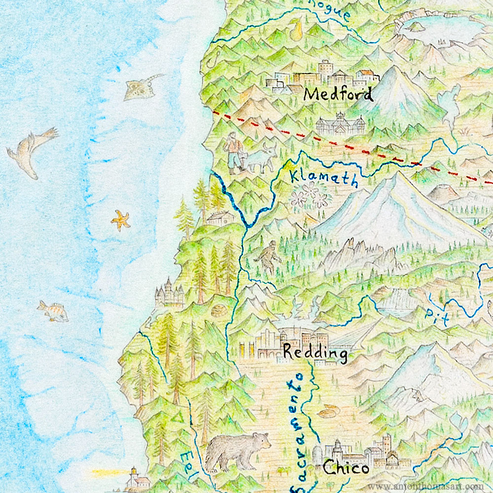 Wandering the great redwood forests, in the shadow of Mt Shasta, is the Sasquatch.
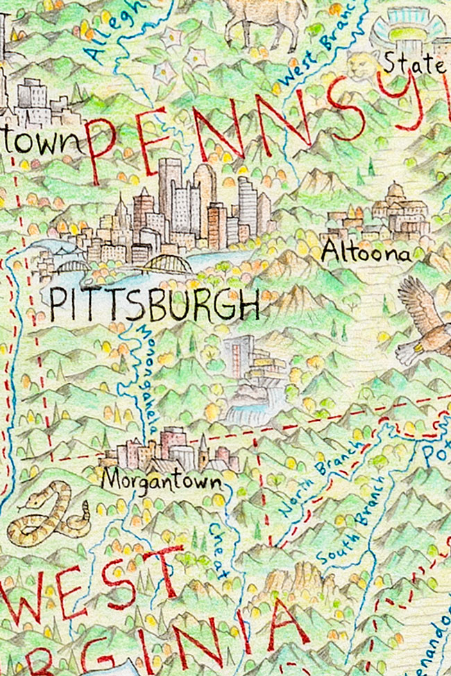
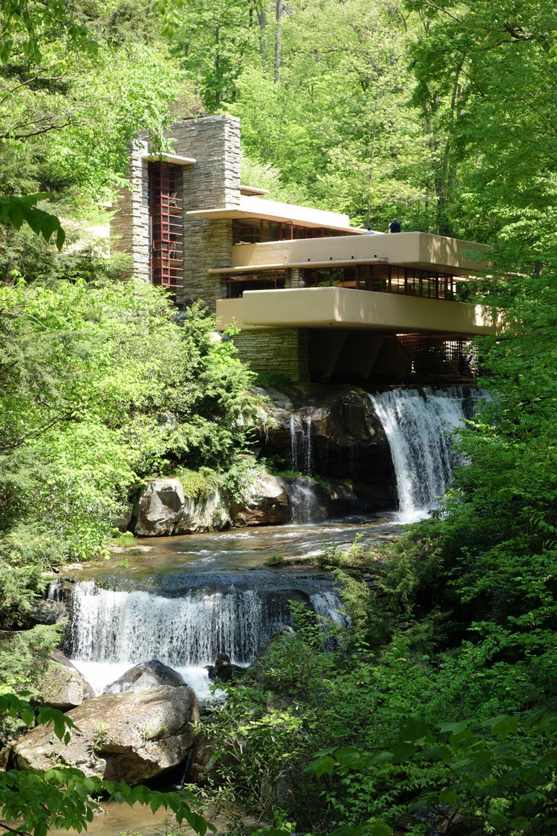
2. The Lionfish – Honduras coastAnimals are everywhere on my maps. They evoke place so well (what says Australia more than a kangaroo?), and are the inhabitants of the land or water that I draw. But not all animals are native, or do they contribute positively to local ecology. I could be referring to livestock of course, but also the problem of invasive species - a problem we know all too well in New Zealand. 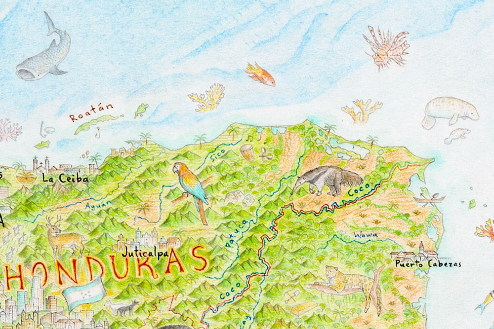 The invasive lionfish (top right) approaches the reef. The Mesoamerican Barrier Reef stretches over 1,000km from the Yucatán to Honduras. It is the second largest reef system on Earth after Australia’s. The lionfish - an invasive species - is one of the most significant environmental challenges it faces. Pictorial maps have often portrayed the world in an idealised fashion. There is good reason for this - every place has its troubles, and it's unfair to focus on trouble unevenly across places. Still, I felt the lionfish told an important story about the ecology of the Gulf of Honduras. Taking advantage of its impressive and menacing appearance, it is drawn here as a kind of villain on the reef. 3. Fallingwater - Southwest PennsylvaniaFrank Lloyd Wright’s masterpiece in Pennsylvania first enchanted me as a little kid. I remember seeing a picture in a magazine and thinking it was the coolest house in the world. Well, some decades later my opinion hasn't changed. Fallingwater is a stunning piece of architecture, so beautifully integrated with its tranquil surroundings. Drawing it only one centimeter (.4 of an inch) tall was extremely tricky, but I'm thrilled it's on the map.
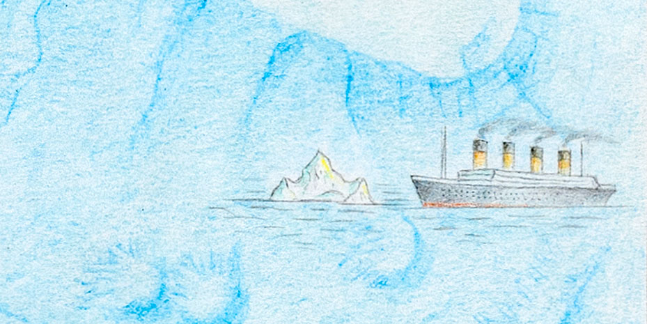
There is another Frank Lloyd Wright building on the map (one that I can remember, that is. There could be more): The epic Falcon’s Nest in Prescott, Arizona. 4. The Titanic - North Atlantic Ocean
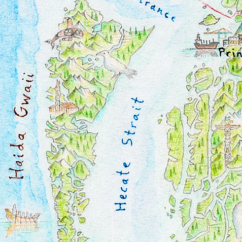
In fact, there are all manner of ships - oil tankers, ice breakers, coastguard, cruise ships, fishing boats, warships, cargo ships, pirate ships, canoes and kayaks - but perhaps no vessel is more famous than the doomed Titanic. It's drawn on the edge of the map, steaming towards an iceberg right where it sank. Notice that it’s just off the continental shelf - the wreckage lies at a truly great depth of more than 12,000 feet. 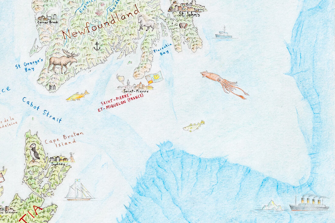 The Titanic steams towards an iceberg (bottom right), in the deep ocean near the edge of the continental shelf. 5. White Raven – Haida Gwaii islands, Canada
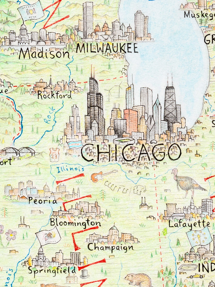
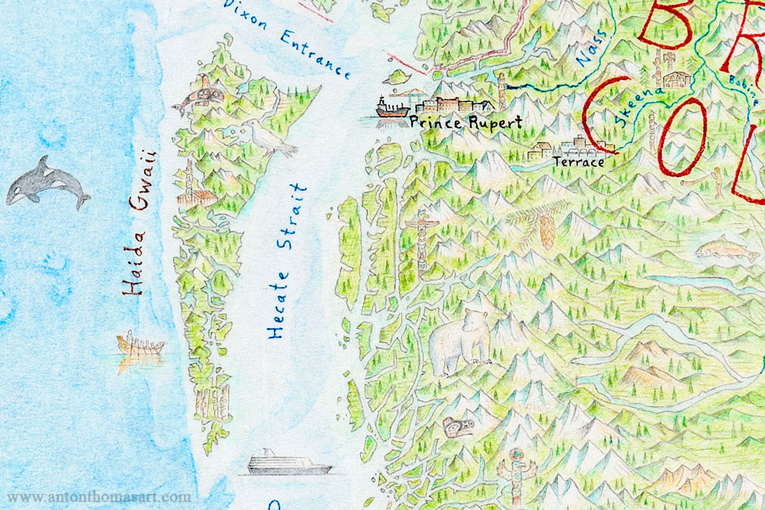 The white raven also matched nicely with the white-furred Kermode, or "Spirit" Bear just across the Hecate Strait on the mainland. You can see it wandering BC's Great Bear Rainforest. 6. Baby, don’t you wanna go? – Chicago, Illinois
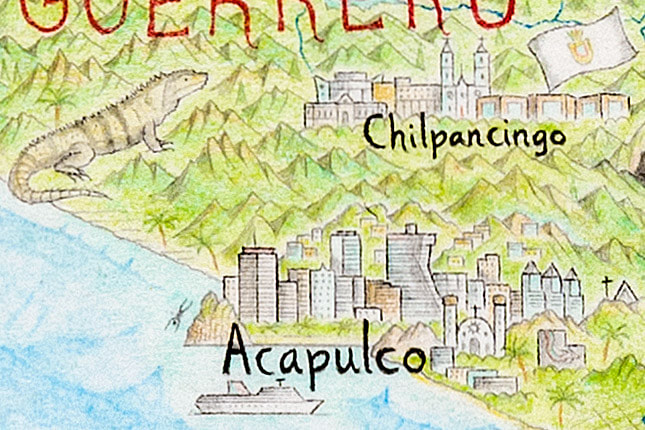
7. La Quebrada cliff divers - Acapulco, Mexico
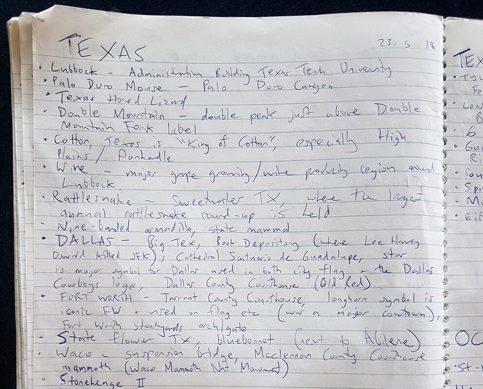
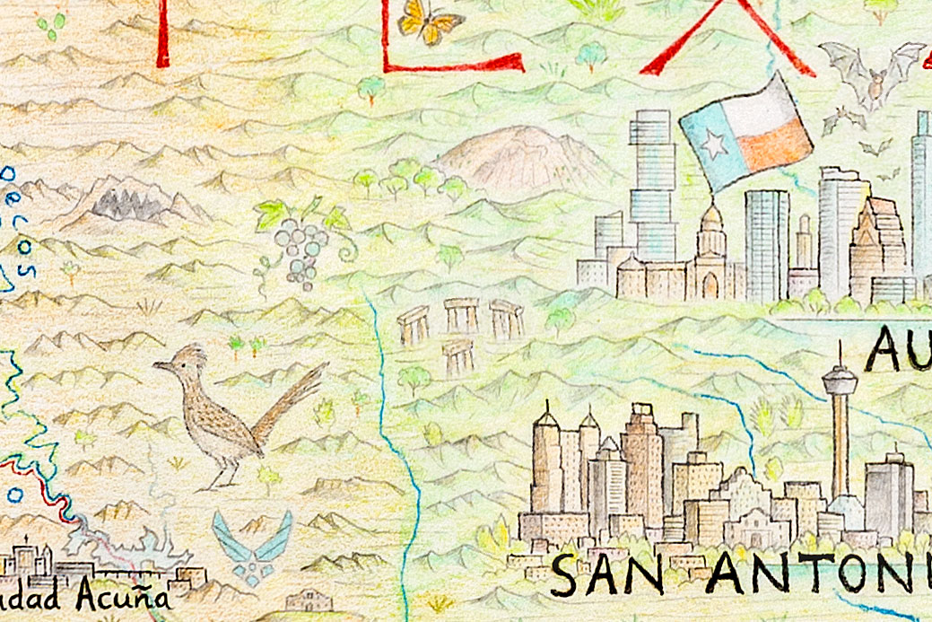
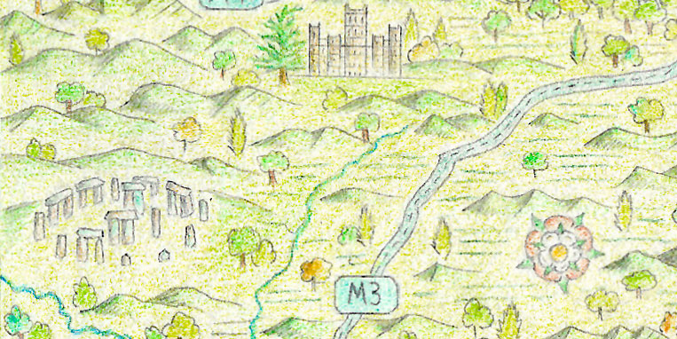
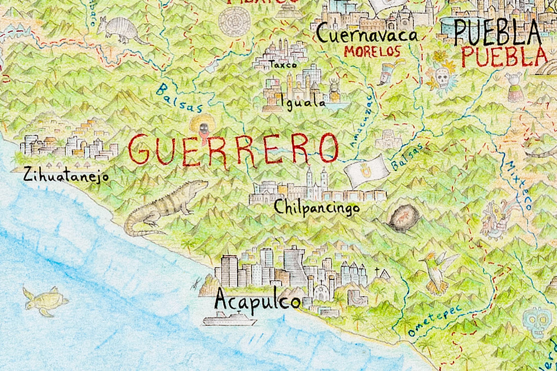 The southern Mexican state of Guerrero is mountainous and heavily forested. Acapulco is the largest city, while Chilpancingo is the capital. 8. Stonehenge II - Hunt, Texas
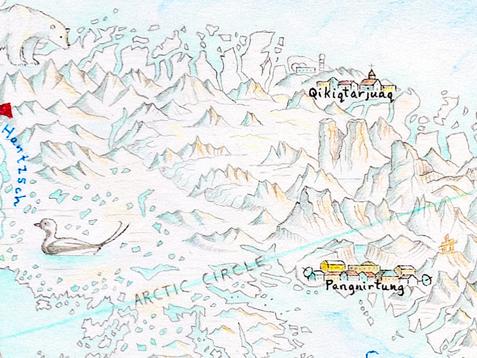
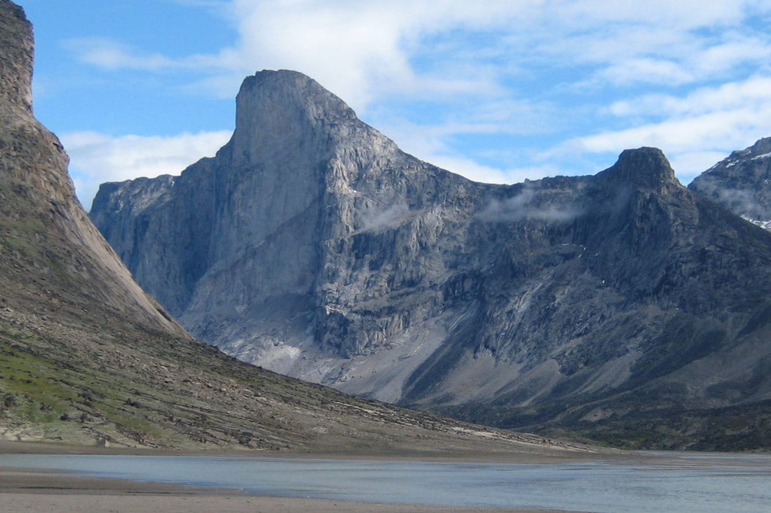
9. Mt Thor - Baffin Island, Nunavut, Canada
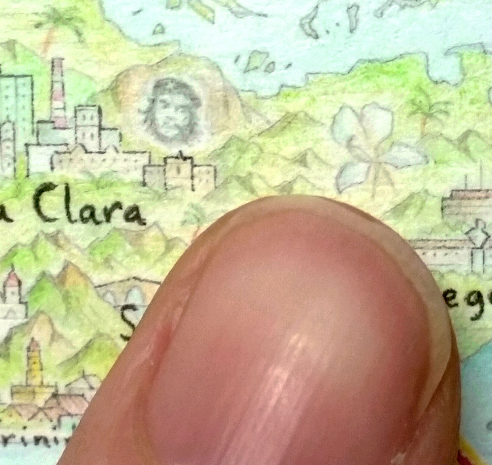
10. Che Guevara - Santa Clara, Cuba
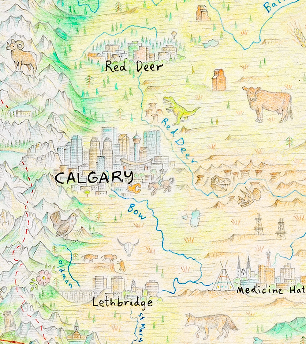
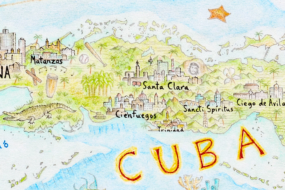 Che Guevara's face at the city most associated with him, Santa Clara. His statue towers above the mausoleum. Also, if you're particularly interested in Cuba, I wrote two blogs about the island while I drew it in 2016. Here is Part 1 and Part 2. 11. Tyrannosaurus Rex – Drumheller, Alberta, Canada
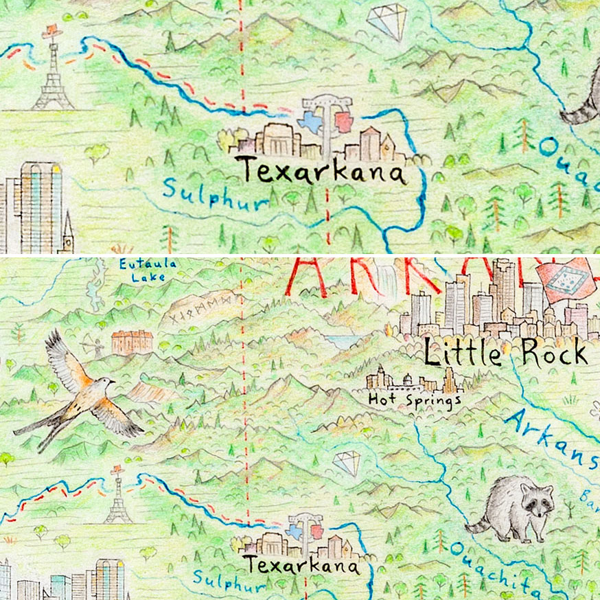
12. Maps within maps - Texarkana, USA
...where would you like to hear about next?
 Half a page from the notebook used during the North America map. With thousands of points of interest, this was essential for me to keep track of what I drew. Previous blog entry: New maps and new mountains (January 2020).
8 Comments
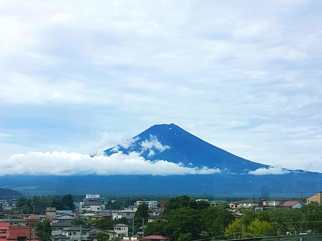
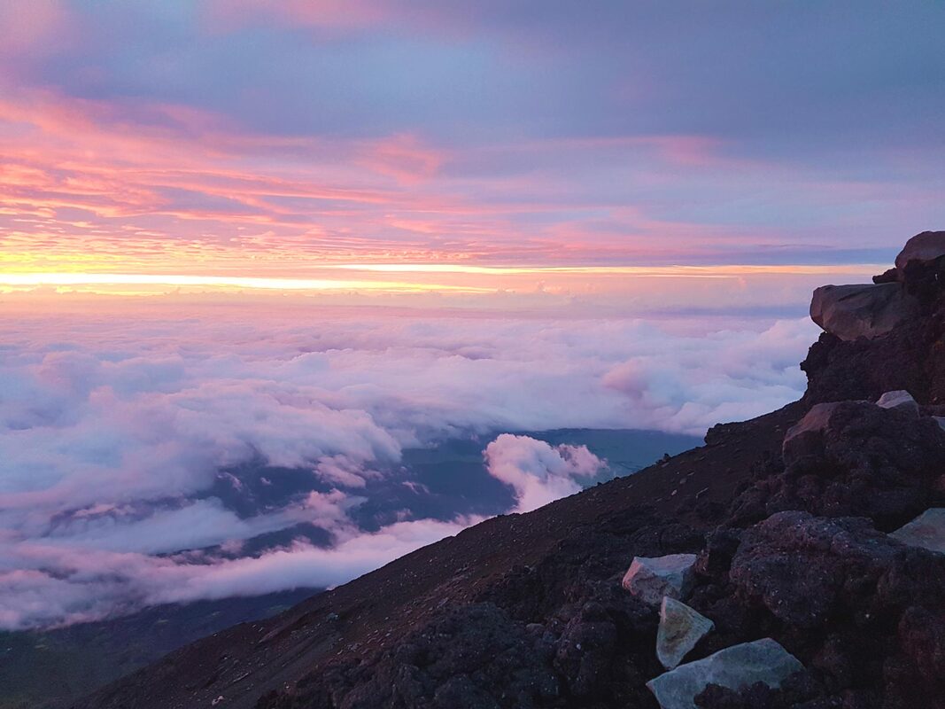
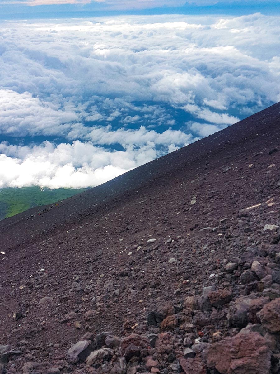
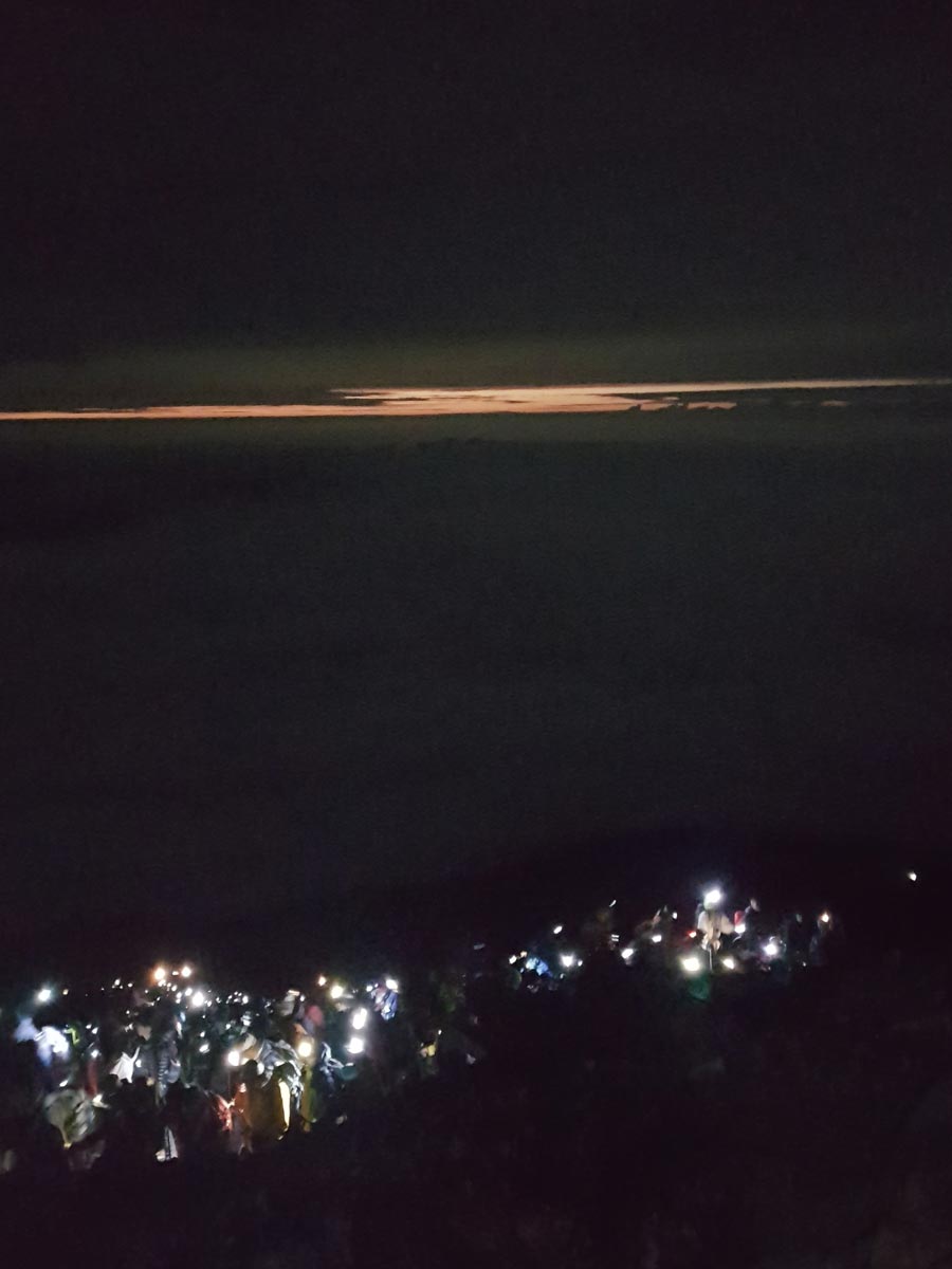
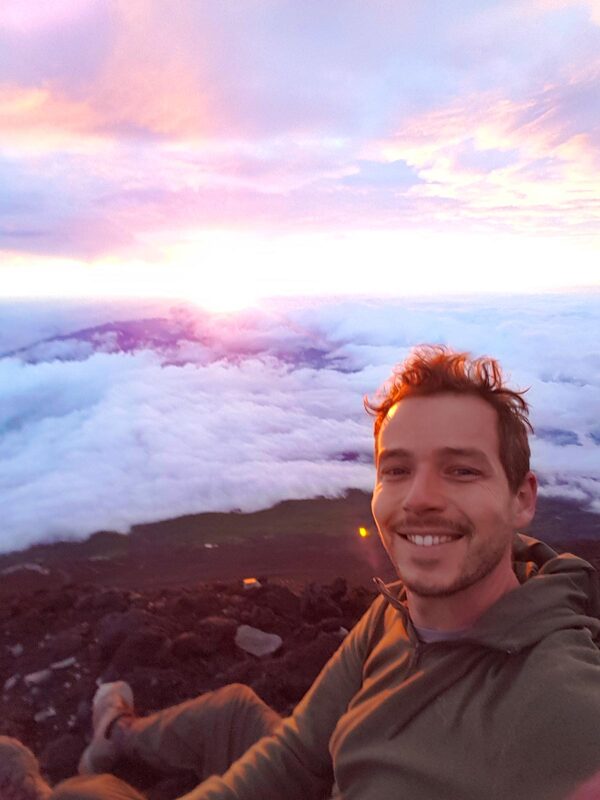
This is a reflection on 2019, following on from the previous entry, How do you finish a map?, which concerns the early months of the year – drawing the cartouche, finishing the map, and getting the piece scanned. This moves deeper into a year that had constant twists and turns... from Tokyo to Tacoma, natural science illustrators to The Washington Post. 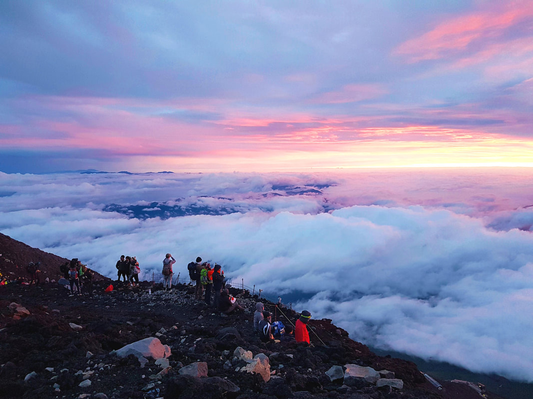 Watching the sun rise from the summit of Mt Fuji, after the International Cartographic Conference in Tokyo in July. So by April, the artwork was finished and digitized. All that was left was to determine how to print and sell a huge oversize hand-drawn map of North America, while based in Australia, having never done anything like it. The way forward was not immediately clear.
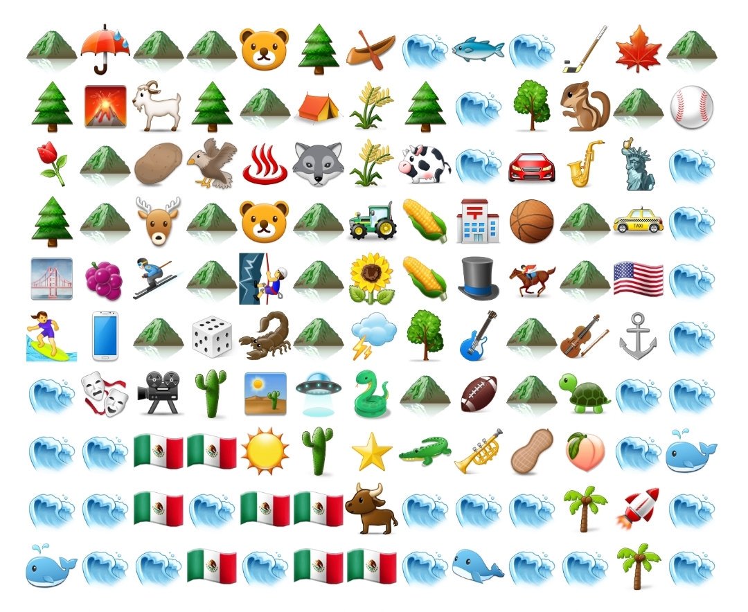 The only map I made between February and June was a tweet. An emoji map of the Lower 48.(@AntonThomasMaps) Contract work for The Washington PostSo I had plenty to do. But life goes on, and other opportunities came knocking mid-year. In April, I was contracted by The Washington Post to draw a series of maps and illustrations. They had an upcoming piece about scientific locations across the Lower 48, and figured my style would be a good fit. I first engaged with WaPo in October 2018, when I gave a presentation to their maps and graphics team while visiting DC. My good friend from the carto world, the extraordinarily talented Lauren Tierney, invited me to visit the Post and I was honoured to share my map with their team. I love the work they do, and the piece sounded great, so contracting for them was an easy decision. 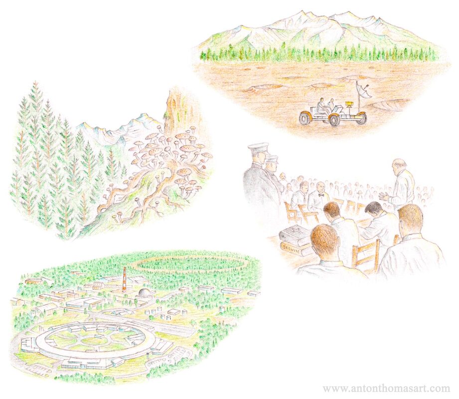 Four of the twelve WaPo illustrations. Clockwise from top-left: The humongous fungus in Oregon, Cinder Lake in Arizona (moon mission training ground), the Scopes Trial in Dayton TN, the Brookhaven Particle Collider on Long Island, NY. 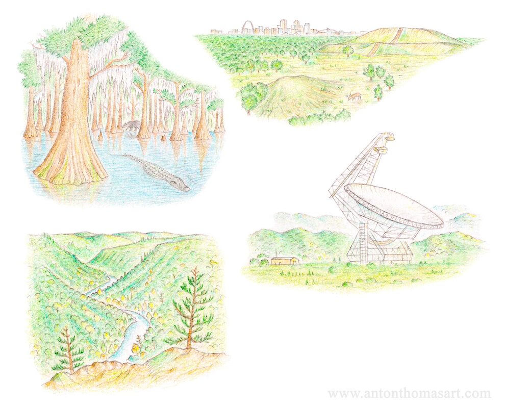 Another four of the WaPo illustrations. Clockwise from top-left: the Atchafalaya swamp, Louisiana. Cahokia, Illinois. The Greenbank telescope, West Virginia. The Grand Canyon of Pennsylvania.
 Guild of Natural Science Illustrators, Brisbane
While it's a US-based organisation, the conference drew many Australian illustrators. Those of us in Aussie were so grateful the GNSI made the trek across the Pacific. It was fun, inspiring, educational and delightfully quirky. The GNSI folks are amazing. It was one of my favourite weeks of the year and I was honoured to be able to speak about my work with this talented and welcoming crowd. I very much plan to go again. A trip to Japan for the ICCNo sooner had I returned to Melbourne than I was boarding a plane to Tokyo. I was off to attend and speak at the 29th ICC (International Cartographic Conference, of the ICA). Partly this was for the conference, but mainly it was because… Japan. 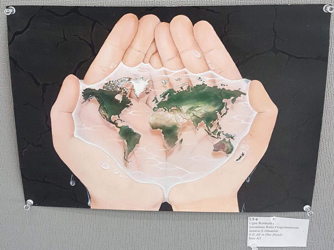 My favourite map from the Barbara Petchenik Children’s World Map Drawing Competition, a highlight of every ICA conference. "It Is All in Our Hands" by Ugne Rimkute from Lithuania, age 15.
Coming next is a blog about the final months of the year, in which I got much closer to the goal of releasing prints, took a trip to the USA for NACIS Tacoma, and got thrashed in the rugged backcountry of New Zealand.
|
 RSS Feed
Interested in press, wholesale, or anything else? Email us at welcome@antonthomasart.com
Copyright © 2024 Anton Thomas Art. All rights Reserved.