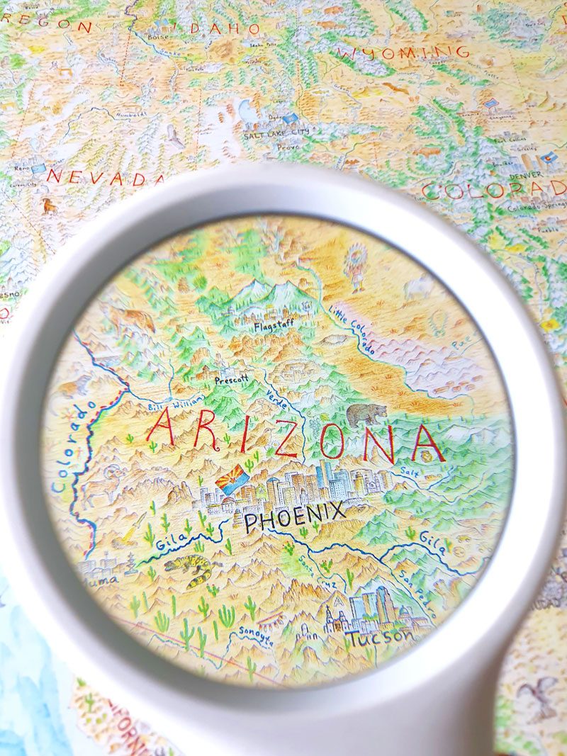
Maps by Anton Thomas
  • Home
  • Shop
  • Story
  • Wild World
  • N. America
  • Videos

Blog

North America Map: the Basics

8/24/2020

3 Comments

 
​Now that prints of North America are finally out there, it’s a good time to unpack its basic conventions. The map might have a whopping cartouche, but it certainly has no key.

Contents
​
  • Basics
  • Projection
  • Cities - selection and population grade
  • Language
  • Extent of North America
Picture

Basics

First, just a quick chart. These were designed to be intuitive and generally self-explanatory, but it's still good to have them outlined!
Picture
Picture

Projection

One of the first things to consider with most maps is its projection.
​
In this case, I simply zoomed out on Google Earth for the appearance of viewing N.A. from space, and traced that onto the paper using a projector. This makes the map a modified perspective projection. It’s important to know it’s not an equal area projection. Scale does vary across the map.

That said, scale is quite similar through much of it. It's where Earth curves in the corners that the difference gets enormous. As areas shift further away, scale shrinks. This is most evident in Alaska, which is rather small on this map.

In real life, Alaska is 2.5x the size of Texas. Compare the two and you'll get a sense of the distortion.
Picture
The original projection used to trace the coastlines in 2014. North America zoomed out in Google Earth.
Picture
The closer to a corner you get, the smaller the scale is.
An equal area projection would have caused a dramatic size reduction through most of the map. Alaska is so huge, and extends so far northwest, there would’ve been less room for detail throughout the project. Also, much more ocean.
​
So... I’m very sorry about that Alaska! But as you’re usually relegated to an inset box (like Hawaii), with an even more reduced scale… I hope this will suffice. I wanted to at least keep you contiguous.

​Also, you'll note the curve of the globe emphasised by labels. State, island and ocean labels reflect the curve where possible. And the curve can be tracked clearly at the Arctic Circle and the Tropic of Cancer – the only lines of latitude on the map.
Picture
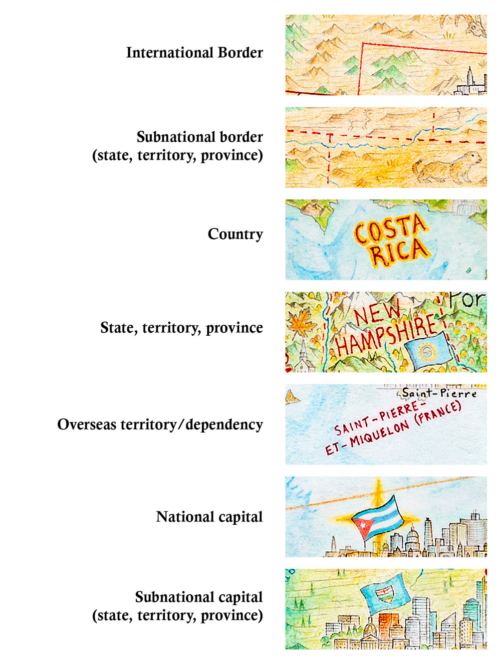
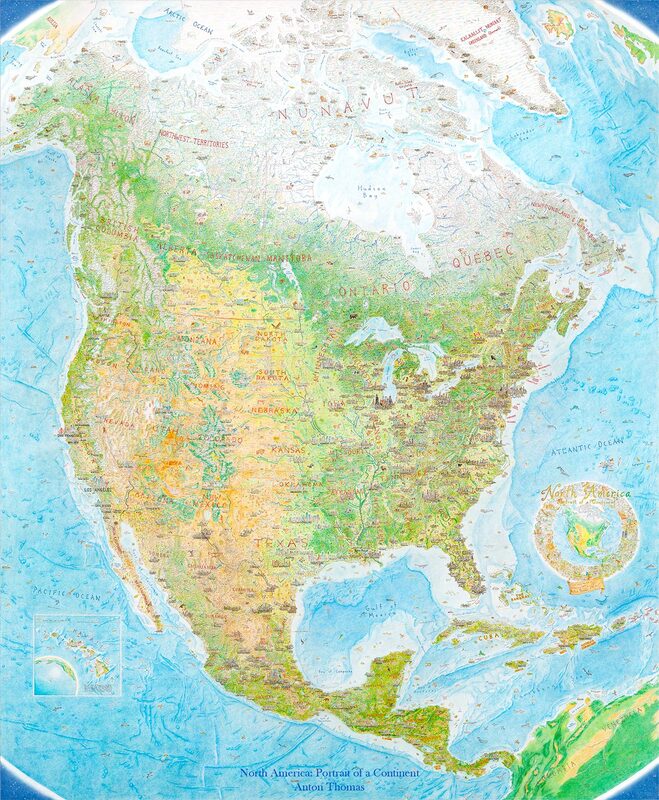
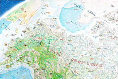
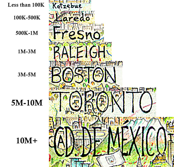
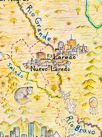
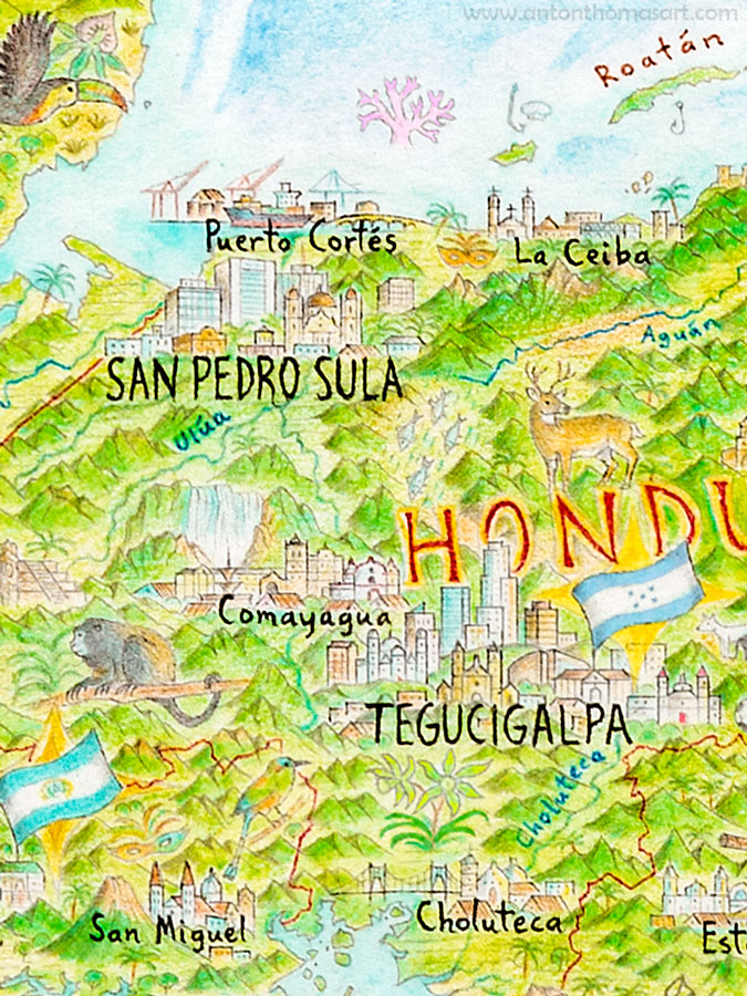
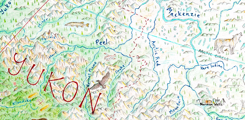
The Arctic Circle running through NW Canada. This line of latitude outlines just how curvy the projection is.

Cities

​Cities were selected based on population. The idea was to include all metropolitan regions with more than 100,000 people, with a much lower threshold in remote areas (particularly Canada/the Arctic). The population bracket of any city would then be displayed through its label size. Once over a million, labels are capitalised.
Picture
The general population guide to metropolitan regions. Cities in the USA are based on metro statistical areas.
There is plenty of inconsistency across the map, reflecting many years of hand-drawing. ​Usually within a region it's consistent, but if you compare say... the Mexico City label to New York's, you'll see the difference. Rather than attempt precision with a metric that shifts over time anyway, the label system was designed to evoke the prominence of each locale.

City selection is perhaps the most controversial element of the project. If your city isn't on there and you think it should be... it can be very frustrating. This is particularly difficult with large metropolitan regions. Skylines require so much space, so I didn’t usually break them into their various hubs.

The metropolitan statistical area list was my go-to for the US, and it was a good guideline for broad metro regions. But some cities have multiple hubs, while some are twin cities.
As short as space was, I wish I could've done a few differently. Examples include Oakland (San Francisco), St Petersburg (Tampa), and San Bernardino (Los Angeles). Cartography is full of constant omission and simplification. Our world is vast. Still, city selection is something I’ll refine in the future, as the single skyline sometimes isn’t enough.
Picture
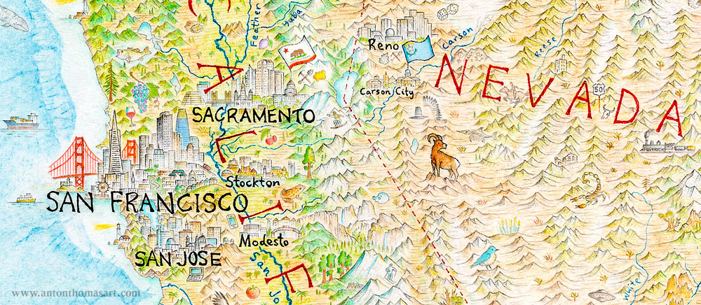
Including Modesto but not Oakland has never endeared me to the Bay Area.

Language
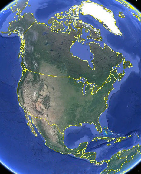
Throughout the map, my general rule for labelling was to label things in the official or most prevalent language of wherever I was drawing. Throughout the USA it was English. Mexico and Central America (except for Belize), Spanish. Canada mostly English, but French in Québec. The Caribbean a mix of Spanish, English and French.
​
This is evident when observing border rivers. It’s labelled Rio Grande on the American side, and Río Bravo on the Mexican. It’s the Ottawa River in Ontario, Outaouais in Québec.
Picture
Rio Grande on the US side, Río Bravo in Mexico.
Picture
The Dominican Republic labelled in Spanish.

​I did this to emphasise the authentic character of how each place is understood locally, though the approach has plenty of inconsistency. For example, the island of Hispaniola is shared between Haiti (French) and the Dominican Republic (Spanish). Both have different names for the island itself, so I opted for the Haitian version (Hispaniola) because it matches the English version I use. The Spanish La Española was not used. Puzzles like this come up constantly with a bilingual approach.
​
While this method can work in the Americas, it may not elsewhere. As long as I'm writing everything by hand, alternate alphabets (from Russian Cyrillic to Japanese Kanji) could scuttle this idea for good!

What is North America?

There are many definitions of North America, and a continent is a rather abstract notion. Earth’s landmasses are perfectly irregular, and they're all islands at the end of the day.

Definitions can vary throughout the world, but the 7-continent model is generally accepted. Asia, Africa, N America, S America, Antarctica, Europe, Australia. I hope throughout my life to draw all seven at this scale, each one being a new portrait of a continent. (Antarctica would be my preference right now...)
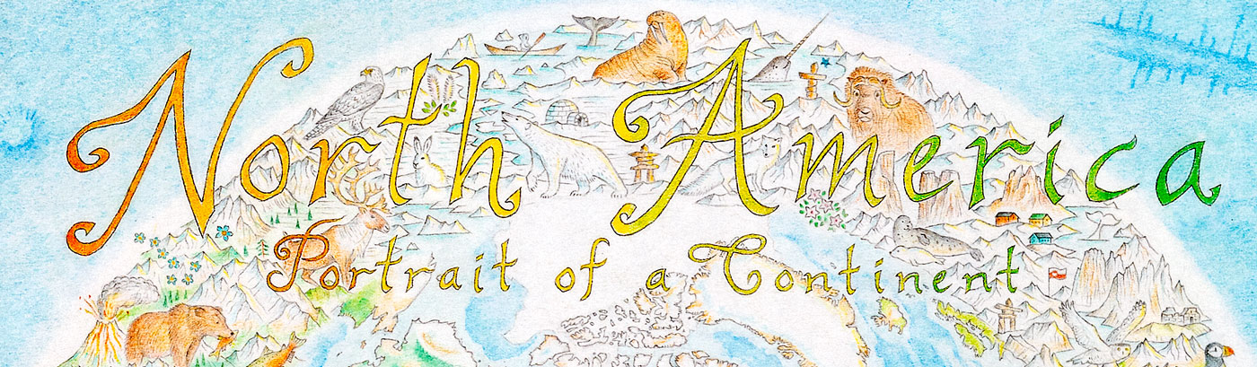
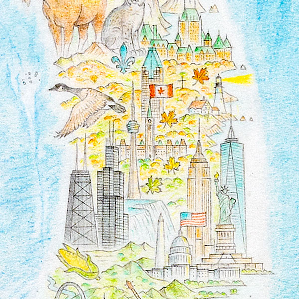
Picture
So, North and South America need a dividing line, and it's generally placed at the border of Panama and Colombia. The legendary Darién gap.

I can understand the concern that Central America and the Caribbean would be enveloped within a North America title. Central is often viewed as its own subcontinent, including within Latin America itself. Still, in terms of the physical geography, Central is more cleanly part of North America.

My broad definition of N.A. is missing three extremities however. Alaska’s Aleutian Islands (the bane of many cartographers... they stretch halfway to Japan), the Caribbean Lesser Antilles, and the very tops of Greenland and Ellesmere Island. Meanwhile, Hawaii is included in an inset map - despite being Polynesian rather than North American. This was to complete all 50 United States, the country on this map with over half of the continent’s population.
Picture
The map detail stops clean at the doorstep of South America.

What else?

With literally tens of thousands of tiny illustrated features, there's a lot more. This blog was just to outline the very basics, but in the next guide I will share some motifs and symbols that are commonly used. These include music, sports, seasons, state and national symbols, history, agriculture, mining and much more.

​Thanks everyone!

Did you enjoy this blog? Check out some more eclectic tours of North America!
​
  • A Tour of North America I
  • A Tour of North America II
  • Drawing North America with Atlas Obscura

And as always, prints are available exclusively in-store. We ship worldwide.
Picture
3 Comments

A Tour of North America II

4/14/2020

2 Comments

 
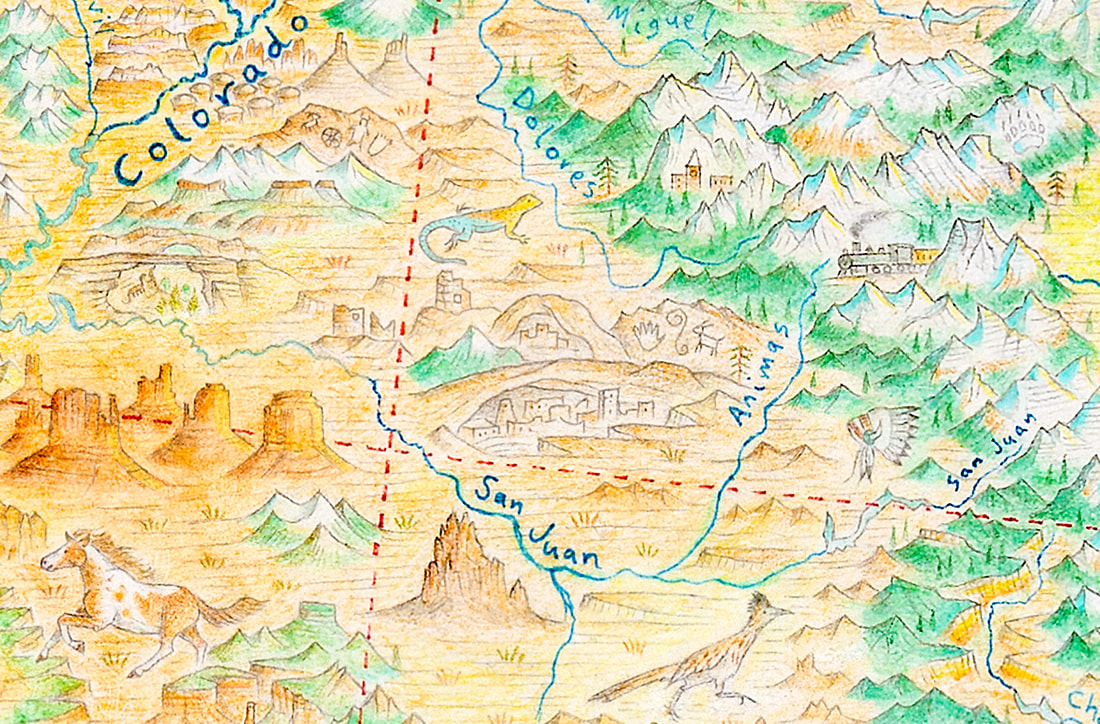
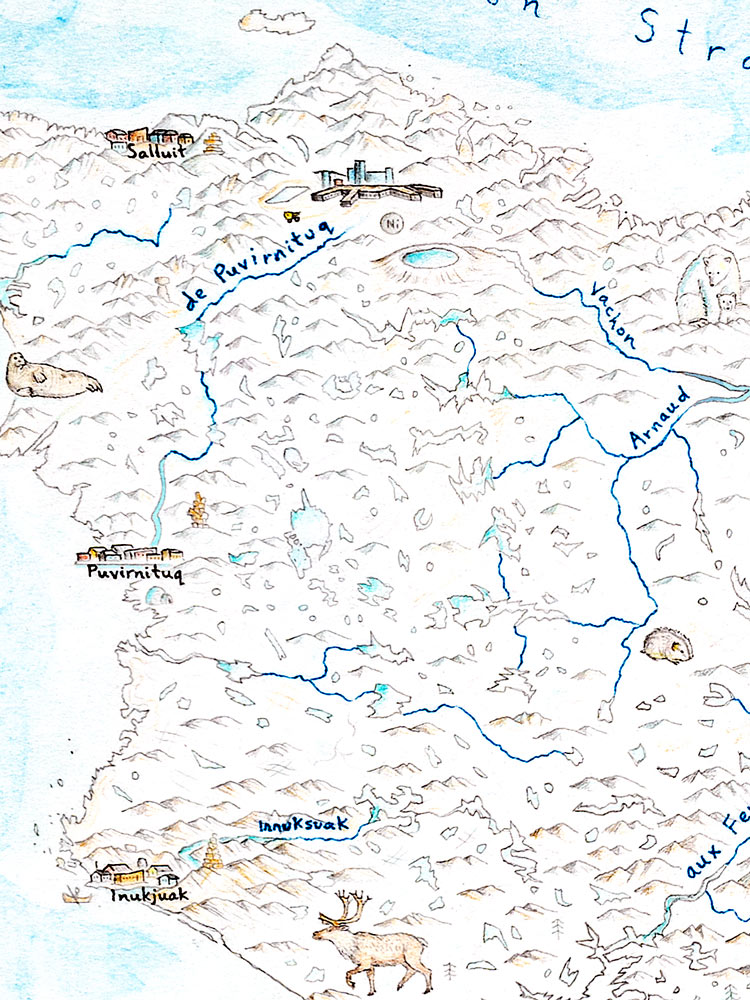
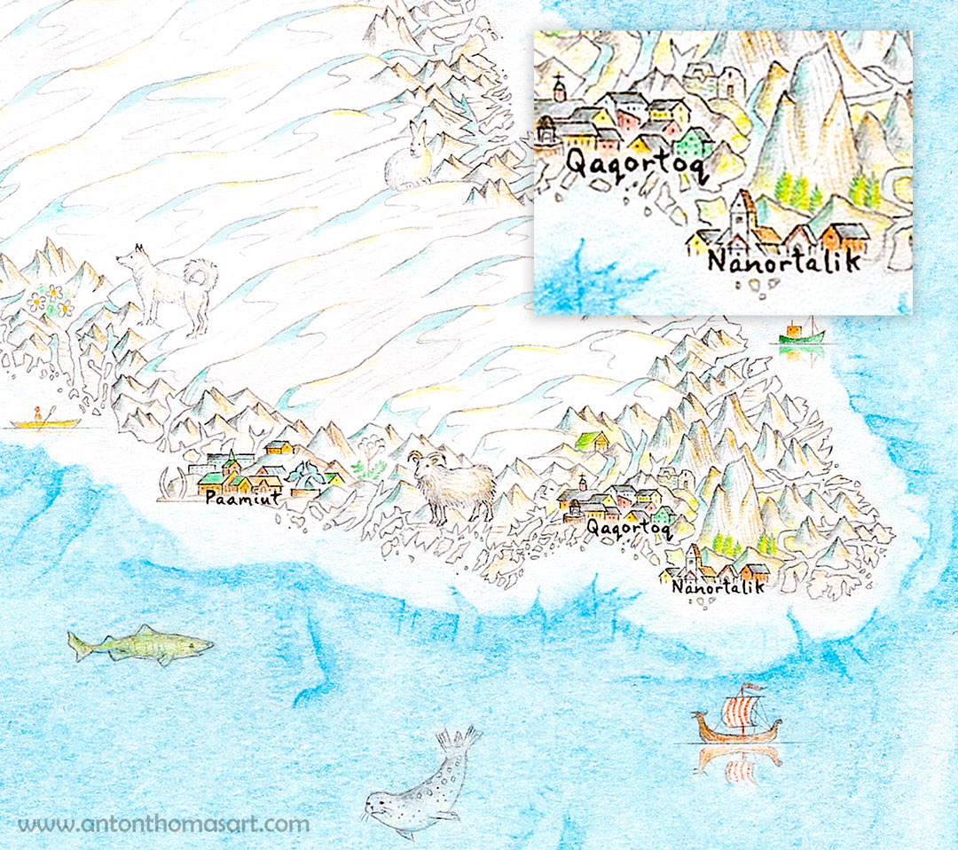
As the first pre-ordered prints of North America start to arrive at their destinations, it's a good time for another tour of the map. Like with the last tour, there is no specific theme. From the mountains of Greenland to the Mexican desert, the Rockies to the Honduran jungle... this is a completely random journey across the map.

​Here are the 12 locations this time:
Picture

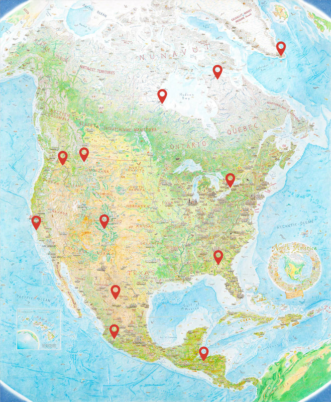
1. Whisper of a grizzly - San Juan Mountains, Colorado

Almost all grizzlies in the Lower 48 are in Montana or Wyoming. They once roamed much of the American West but have mostly been driven to extinction - including in states with plenty of habitat. It was declared extinct in Colorado in 1953 but, in the rugged San Juan Mountains, rumours of grizzlies go back for decades.
Picture
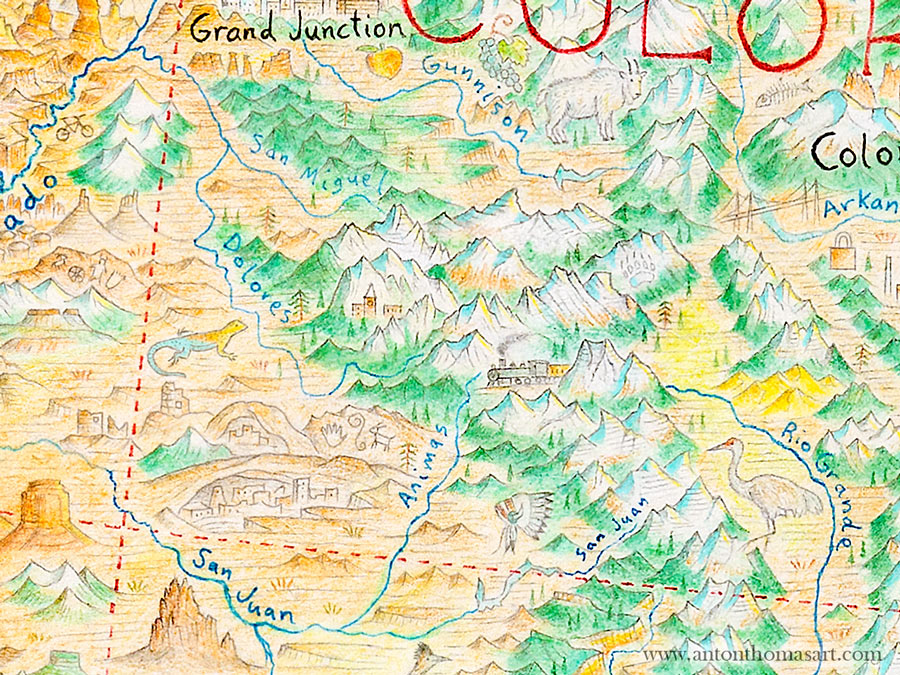
A grizzly paw print marks the eastern flank of the San Juan's. The highest peak, Uncompahgre, can be seen just northwest of the paw print.
​Dominating the southwest quadrant of the state, the San Juan Wilderness is vast. And many sightings throughout the years have been credible. I’m not weighing in of course - I wouldn’t have a clue! But grizzly rumors are as much a part of San Juan lore as the Durango-Silverton railroad.

​I didn’t want to commit by drawing an actual griz, so I went with a pawprint. Rather than a confirmation, this is more... the whisper of a grizzly. 

2. Pingualuit Crater - Nord-du-Québec

Picture
Picture
The bright blue waters of Pingualuit can be seen in far northern Québec.
The Pingualuit crater looks part-moonscape, part-ice world. ​​An almost perfectly circular impact crater, its shape and dazzling waters are striking amongst the tundra. Pingualuit lies deep in the northern reach of Arctic Québe​c.

​Its lake is very deep (1300 feet/400m) and holds some of the purest, most transparent water in the world. 115 feet/35m visibility has been measured here.

​The Inuit have long referred to Pingualuit as the “Crystal Eye of Nunavik”, and it is a place of mystery and beauty. It’s also extremely remote - Montréal is closer to Atlanta than Pingualuit! The nearest node of civilization is the Raglan Nickel Mine (also featured), a site that has raised concerns about its impacts on the crater.

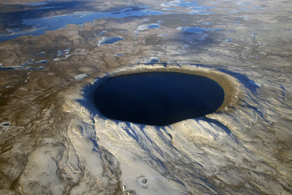
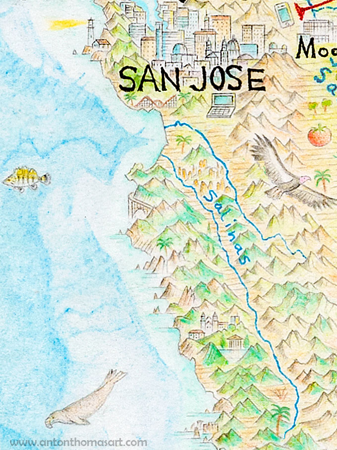
3. Big Sur, California

​Hit 17 straight out of San Jose, drive over the mountains, get onto the 1 at Santa Cruz, head past Monterey, and suddenly everything changes. Spectacular Pacific coastline unfolds – forest staggered on cliffsides, ocean crashing into the continent, fog and solitude and beauty. Big Sur is breathtaking and it has a mystical place in American culture.
 
There is so much that could be drawn here (as with California generally), but I could only fit a few things. From top-to-bottom you’ll see the Bixby Creek Bridge, followed by McWay Falls – a waterfall that falls onto a sandy beach. Keep going and there’s the castle of newspaper magnate William Randoph Hearst, a property so lavish it will make your jaw drop. Finally, Big Sur ends around the elephant seal rookery.
Picture
Picture
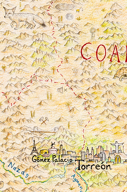
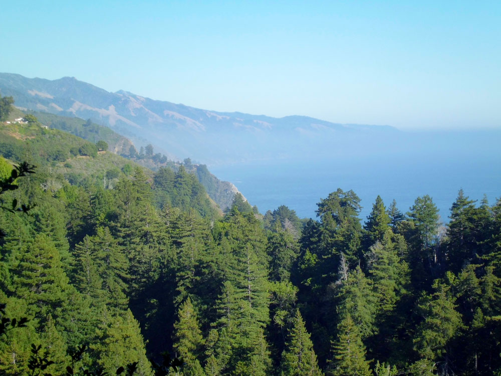
The view from Nepenthe, Big Sur (a photo I took while visiting back in 2011 during my first month in the US).

4. Mapimí Silent Zone – Durango, Mexico

Picture
A mute symbol marks the Zona del Silencio.
This is a strange one. The Mapimí Silent Zone, or Zona del Silencio, is a stretch of desert in northwest Durango steeped in urban legend. In 1970, a US military test rocket was fired in Utah and went way off-course, careening all the way to Mexico where it crashed in the desert. Once the wreckage was found in Durango, the US Air Force launched a recovery operation in which they removed the debris, as well as some contaminated top soil.

Since then, rumors of extraterrestrials, paranormal activity and mutated wildlife have turned the area into something like Mexico’s Roswell. Enthusiasts known as silenciosos are seen as nuisances by some locals. Most famous is the claim that no form of communications can be received here. Radio, cellphone, anything. It’s even said compasses won’t work.

​And so it is the Silent Zone, and I represented it with a universal symbol of silence – a mute.

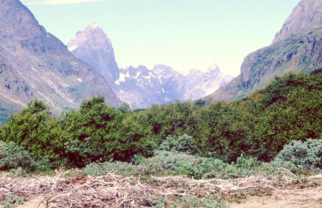
5. Greenland's forest - Qinngua Valley, Greenland

Greenland isn’t the first place you think of having forests, and indeed – what isn’t covered by ice cap is mostly barren and rocky. But if you peer down to the southern tip of the island, you’ll notice a few trees drawn near the walls of Ketil Mountain.

​In a steep valley sheltered from the harsh winds of the ice cap on one side, and the fierce Labrador Sea on the other, is the only natural forest on Greenland. The Qinngua Valley (Greenlandic for “paradise valley”).
Picture
Picture
​This beautiful valley lies between 5000-foot peaks, and at a glance could be mistaken for Norway or New Zealand. While more of a thicket than a true forest, the tallest trees (downy birch and gray-leaf willow) can reach 25 feet tall.

​While Greenland has a famous lack of greenery, on an island the size of a subcontinent there can always be surprises.

6. Georgia on my Mind - Albany, Georgia

​In downtown Albany, Georgia, overlooking the gentle waters of the Flint River, is a life-size statue of Ray Charles. The musical genius himself was born here, and the statue finds him at a grand piano, leaning back in his distinctive pose.
Picture
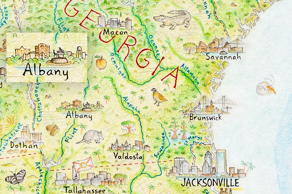
I chose to include the statue for several reasons. First, it’s an Albany landmark, and Ray Charles is the most famous person from the city. Secondly, I’m a huge Ray Charles fan. And finally, Ray has an especially powerful connection to the Peach State, thanks in part to his classic track Georgia on my Mind. Placing him on the piano down there in Albany conjures up his soulful voice singing… “Georgia…”

7. Rain of fish - Yoro, Honduras

Picture
Every year, at the onset of the first rains, it is claimed that fish rain down on the town of Yoro, Honduras. Much about this rain of fish, or lluvia de peces, is unclear. Some suggest that they might wash up during flooding rather than fall from the sky. But whatever the fish rain is, it's viewed locally as a divine miracle.

Every year, Yoro holds the Festival de Lluvia de Peces to honor the event. Legend has it that in the mid 19th-century, a Spanish priest named Father José Manuel Subirana visited Yoro and, distressed by the poverty in the town, he prayed to God for food. He prayed for three nights straight, and on the third night fish began to fall from the sky.

The raining fish can be seen on the map near the white-tailed deer, the national animal of Honduras.

8. Polar bear truck - Churchill, Manitoba

Picture
If you want to see polar bears, Churchill is the place for you. It promotes itself as the “Polar Bear Capital of the World” – which is a seriously cool (although slightly terrifying) slogan. While Churchill residents are accustomed to life around polar bears, most tourists experience them from a special truck designed for this exact purpose - a Tundra Buggy.
 
The vehicle looks like a monster truck school bus built for an ice planet. And as you may have noticed, my proportions are slightly off... A Godzilla-sized polar bear towers above a truck it could destroy with a single paw. Still, proportions aside - there’s no question that polar bears are the biggest thing in Churchill.

​Also featured is the Prince of Wales Fort - an old bastion fort originally built by the Hudson's Bay Company in 1717.
Picture
Nothing says Churchill, Manitoba quite like a polar bear.

9. Niagara Falls

One of the most famous sites in North America, Niagara Falls needs no introduction. Along with the map proper, it’s on the cartouche to create a natural boundary between the US and Canada. In this case, Chicago and Toronto representing the Midwest and Ontario.
 
On the map itself, only the crest can be seen as the falls drop away. The Niagara River flows northwards into Lake Ontario, and it wasn’t suited to a front-facing depiction (as is standard for most waterfalls on the map). I like that you get a sense of the steep elevation drop at the falls, where the waters of four Great Lakes crash towards a fifth.
Picture
Niagara Falls can also be found on the cartouche, creating a dividing line between Canada and the United States. Here it represents the Great Lakes as much as it does the Falls.
Picture
Top - Niagara falls now. Bottom - The falls flowing the wrong way before being fixed.
They’re flowing the right direction now, but... they haven’t always. Readers with a copy of NACIS’s Atlas of Design Vol. III can flick to pages 56-59 and see a much earlier version of the map.

​Much of what's shown there has since been redrawn or reworked, and it's fun to compare with a print now. If you cast your eyes to Niagara Falls, you’ll notice they're totally flowing the wrong way. Lake Ontario is flowing into Lake Erie! It's unthinkable now, but in those earliest days (2014) I remember having no confidence drawing a waterfall from the top, so I figured hey – who would notice? Well, turns out that of course, many people would notice! So remember: live, learn, and get your damn waterfalls right.

Looking at the 2014 version it seems I also fixed up the droopy grapes south of Hamilton.

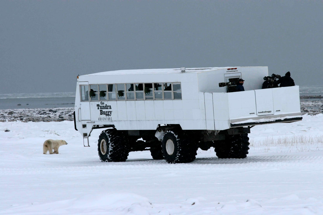
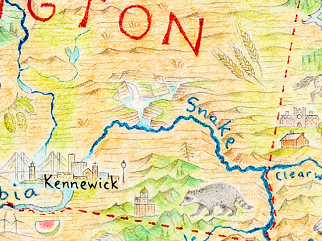
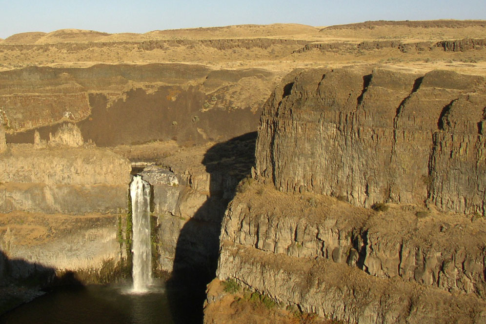
10. Palouse Falls - Eastern Washington state

Picture
Following with the waterfall theme, here is a completely different cascade - one that is far less famous.

​The Palouse River carves a dramatic canyon through the eastern Washington scablands, and tumbles over this 60m (200-foot) drop on its way to the Snake. It looks like a beautiful place, and as that region of the Pacific Northwest is known as the Palouse, it seemed perfect to place its namesake waterfall prominently.
​I have no idea how many waterfalls are on this map. I’ve drawn them in Jamaica, Alabama, the Yukon, and everywhere else. Each one is different, but Palouse Falls is one of my favourite.

That said, plenty of others come to mind… Mexico’s spectacular Basaseachic Falls… Yosemite’s Bridalveil... BC's Helmcken Falls... Maybe I should do a tour entirely on waterfalls.
Picture

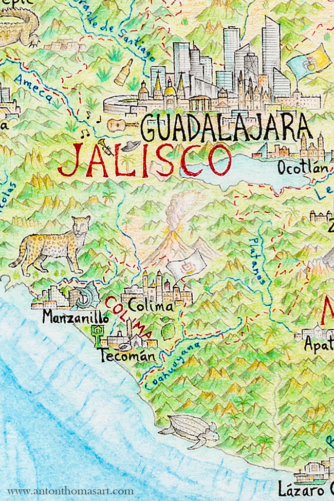
11. Volcán de Colima - Mexico

Picture
The Colima volcano in central-west Mexico. Look to Alaska, Hawaii and the Pacific Northwest for other eruptions on the map.
Whenever it’s time to draw a volcano, it’s tempting to make it erupt. Eruptions are evocative, fun to draw and filled with drama. But it's easy to overuse them, and with dozens of volcanoes across the map I can’t just draw them all erupting (I'm not trying to depict armageddon). So, which ones to choose?
 
North America’s volcanoes run mostly in three arcs along the west coast – the Alaska Peninsula, the Cascades of the Pacific Northwest, and then from Mexico through Central America. There are many active volcanoes including some famous for their eruptions such as Mt St. Helens, or Mt Redoubt in Alaska. I tend to choose volcanoes that are either very active/volatile, or had famous eruptions.
 
The Colima volcano sits on the border between the states of Colima and Jalisco. It is one of the most active in the world, and it erupts at a rate well above the ordinary. I drew it back in 2016 while the volcano itself was calm, but a few months later it began a series of violent eruptions that lasted into the following year.

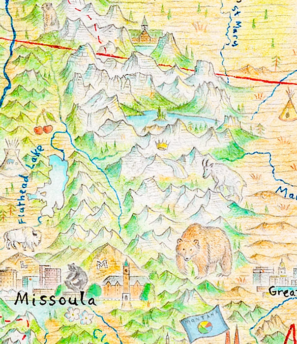
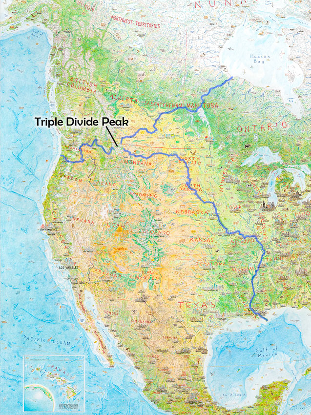
12. Crown of the Continent - Montana

This magnificent stretch of the Rocky Mountains in northwest Montana is often dubbed the "crown of the continent”. One visit to Glacier National Park and it’s easy to see why. Here at the continental divide, majestic mountains soar and wildlife are abundant - including large populations of grizzlies.

​It’s an awe-inspiring landscape that I was lucky to visit in 2017, and shortly afterwards I drew Montana on the map. I figured a crown somewhere might be appropriate, and I chose to place it on Triple Divide Peak.

Triple Divide is an incredible phenomenon. On this one peak, water clearly flows to three different oceans: the Pacific, the Atlantic, and the Arctic. ​This is the only triple oceanic divide in the world, and is thus the hydrological apex of the North American continent. ​
Picture
The crown of the continent was placed just next to triple divide peak, which sends water to Hudson Bay, the Gulf of Mexico and the Pacific Ocean.
Picture
Follow the rivers from the crown of the continent...
Check it out on the map! Starting at the crown, trace your finger north through St Mary Lake to the Saskatchewan system, eventually to Hudson Bay. West through Flathead Lake to the Columbia and the Pacific. East along the Marias all the way down the Missouri/Mississippi to the Gulf of Mexico.

NOTE – it’s arguable whether Hudson Bay is an Arctic water body. It could also be seen as a marginal sea of the Atlantic. But in terms of its frozen conditions, its biome, its location on the continent - it’s pretty damn Arctic. Still, if this description doesn’t satisfy, North America has an alternative triple divide up in Canada called Snow Dome.

​I wrote an entire blog in 2017 about the triple divide, my Montana trip and the Snow Dome debate here.

Where would you like to explore next?

Thanks for taking the tour! If you haven't read the first one yet, here it is. Now that prints are starting to ship out and more people begin receiving their maps, I feel these tours will be well suited.

There are literally endless details here, and there's no doubt you'll have questions. I'm always open to answer them, and if you'd like me to focus on a specific feature, or a place, or a theme - leave a comment right here on the blog! I might include it in the next tour.

Until then,

-Anton

  • Buy prints of North America: Portrait of a Continent
  • A Tour of North America - Part 1
  • Home
Picture
2 Comments
<<Previous
Forward>>

    Archives

    November 2022
    December 2020
    August 2020
    April 2020
    February 2020
    January 2020
    December 2019
    September 2018
    December 2017
    August 2017
    February 2017
    October 2016
    September 2016

    Categories

    All

    RSS Feed

Picture
  • Home
  • Shop
  • Story
  • North America Map
  • Wild World​​


  • Press
  • Videos
  • Portfolio​
  • Blog​
  • ​Contact


    Subscribe for occasional updates about new releases, sneak peeks, and more!

Subscribe
Interested in press, wholesale, or anything else? Email us at [email protected]

Copyright © 2025 Anton Thomas Art. All rights Reserved.
  • Home
  • Shop
  • Story
  • Wild World
  • N. America
  • Videos