|
Perhaps it's never finished, you just... stop. 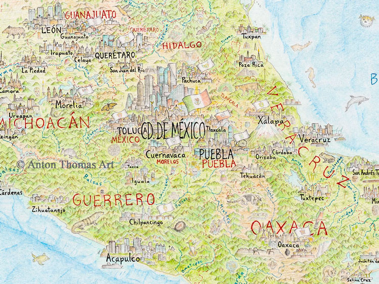 What a year it has been! It began with the completion of the map, and now it closes with prints on the brink of a presale release. That's right, you did read that correctly - it's finally happening! At long last, the prints are going on presale very soon - within February 2020. The preorder period will run for a month, before printing and shipping begins later in March. I’m communicating about prints most with my email list, so if you’re not on the list and want to know as soon as prints are available, be sure to sign up here. 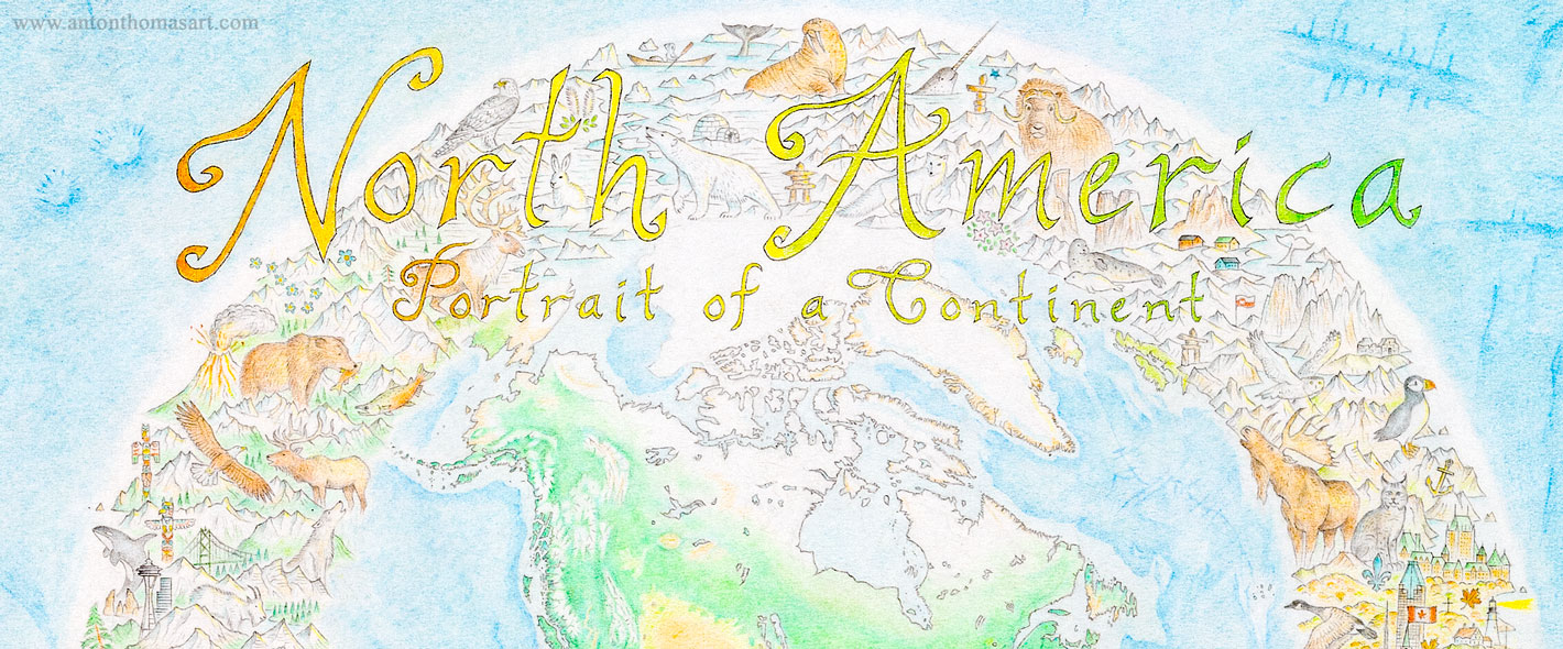 So with the map almost on sale and the year winding up, I've been reflecting on 2019 a lot. I wrote a reflection on the year but it's too long for a single blog. Instead, I think I'll release it in chunks. So here's the first part. This entry goes back to the early part of the year, with the final completion of the map, its very detailed cartouche, what it actually felt like to sign off in that final moment, and the all-important final scan.
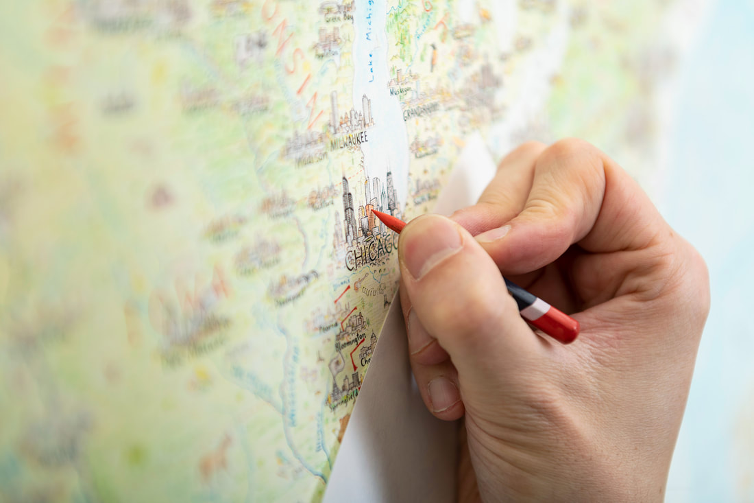
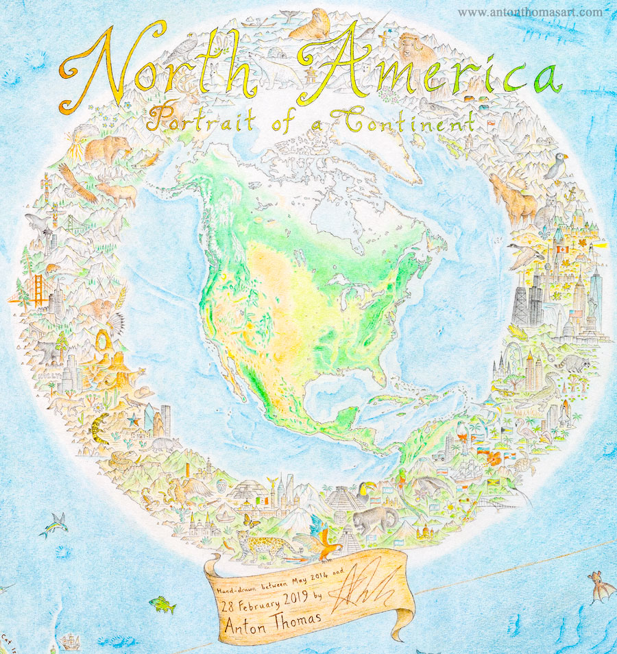 The cartouche of the North America map. This took longer than some standalone maps I've drawn. Placed in the Bermuda triangle, it took 150 hours to draw. Given the scale and detail of the map, I felt the cartouche had to do it justice. I wanted it to be emblematic of the project. Plus, I needed a place for the title, and somewhere to sign and date it. But it's very hard to sum up a project that dominated your life for years. If you've been lost wandering its trees for that long, how do you now describe the forest? North America: Portrait of a Continent sits across the top, with a colour grade of Earth tones. The design of the cartouche is exactly that: a portrait of North America. A mini map, same projection, is surrounded by a frame of dense detail. Unlike the endless content of the map proper, the mini map allows North America to simply be. Just coastlines, land cover, faint urban sprawls and bathymetry.
Completing the map, once and for all
Image capture
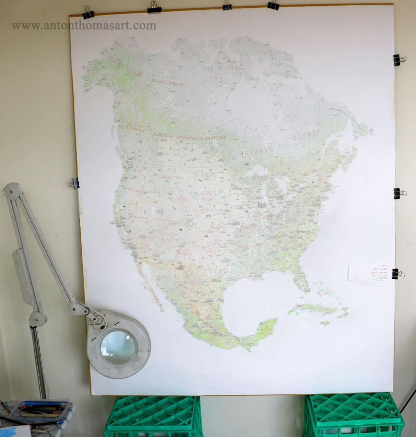
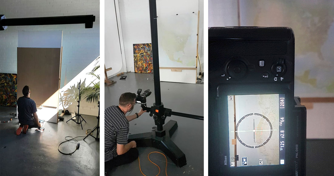 Justin working on the final image capture of the map. Luckily I didn't have to return to Sydney, an amazing photographer in Melbourne, Justin Cooper, came to the rescue. We created a mount for the map, attaching it to the wall to keep it flat and parallel to the lens. Justin’s camera was on a stand that he slid down and across to capture the map in 25 separate frames. We timed every exposure to have the same intervals, to keep the flash refresh rate consistent. Justin is amazing! Using Photomerge on Photoshop the frames were stitched together. The result was almost seamless and so finally, after years of work, I was presented with an enormous and beautiful capture of the map. Having that file is amazing, and gives me so much peace of mind, but it has also opened up new possibilities for procrastination… 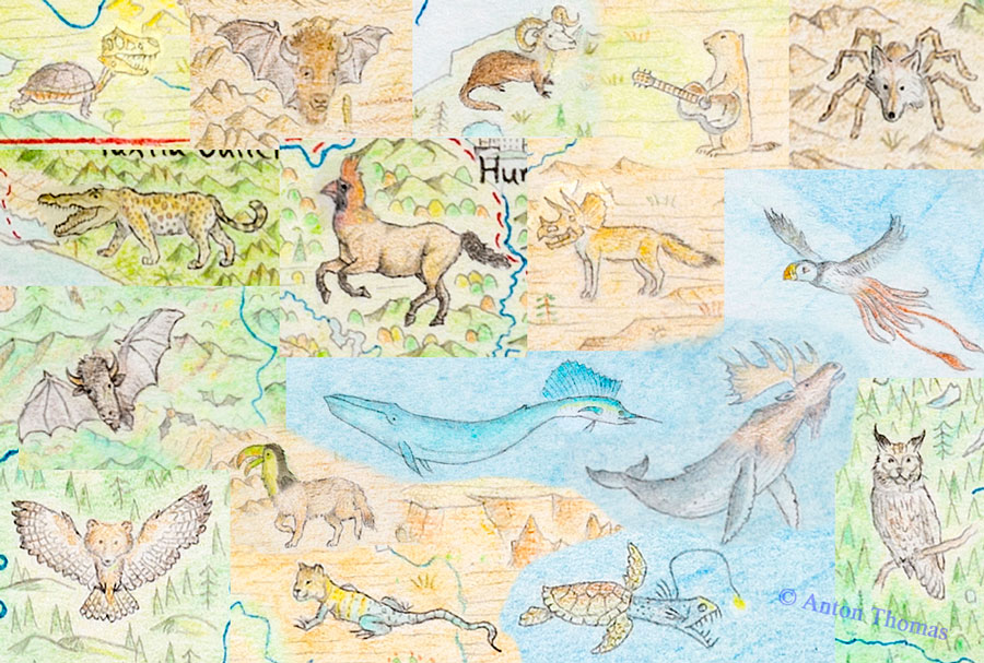 Giant map scan + Photoshop = infinite map monster potential. I'll leave it there for now! I'll be posting the next segment of my year reflection soon, and the print news will keep coming to those on the email list. Until then, I'll leave you with the following video. I gave this talk at the NACIS conference in Tacoma in October, and I'm really excited to share it. It's my most personal talk yet, and I open up about the completion of the map, the journey to releasing prints, creativity and obsession, and the psychological experience of drawing one map for 5 years. I hope you enjoy: Also, are you following on social media? My most regular day-to-day updates happen there! Stay in touch with the wild world of hand-drawn maps:
0 Comments
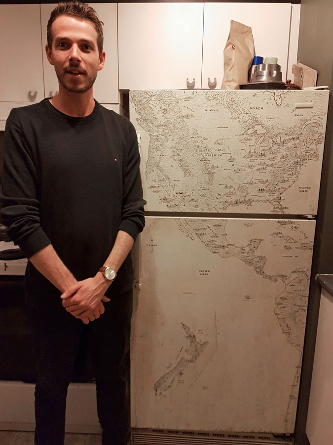
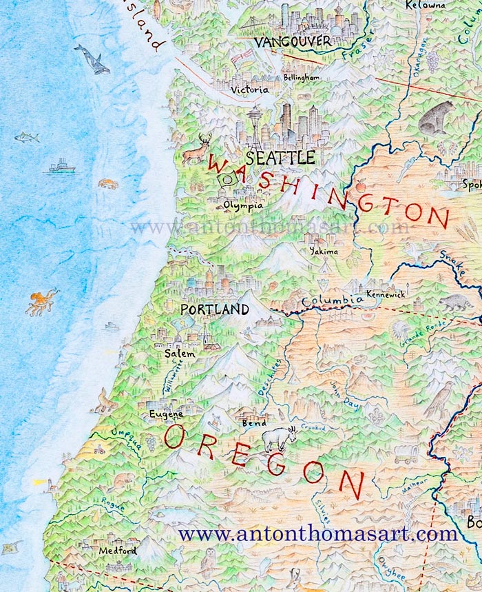
It has been a long time coming, but The North American Continent is at the finish line. I'm now deciding how to print it. So, where's it all at? 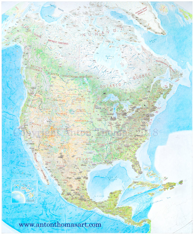 "...but I preferred reading the American landscape as we went along. Every bump, rise, and stretch in it mystified my longing." It started on a refrigerator in Montréal six years ago. For two years prior I explored the US and Canada, and a childhood love of maps was ignited to a point of no return. Geography came alive. My world was expanded as I experienced the continent of North America, a 21 year-old from an island country. New Zealand is beautiful, majestic. It is diverse and it is not small. But a continent is a continent. 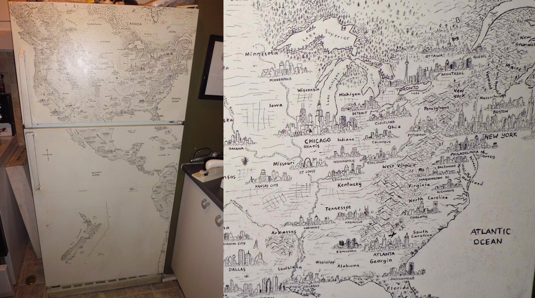 Found myself living in Montreal, and it's late 2012. As the Fall progressed and the city went inside, I went inside too. My time was almost up after 2 years on this continent, and I couldn't stop thinking about the long skies. This great rolling land I'd gotten lost in, with all its mountains, deserts, plains and cities. A geographic theatre laid out like a masterpiece of heavenly proportions. So I drew North America on a fridge. Well, most of it. And the western spine of South America. And an inset map of New Zealand, because... why not?
The fridge was not this map. But I never turned back. 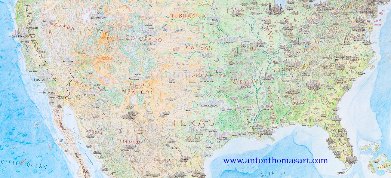 It's 2013 and I've settled in Australia. Perth was home now, and I immediately started work on a new map. No more household appliances, this time it'd be on paper. I'd learn to use colour pencils. I'd put in some serious hours. I spent 6 months drawing South Asia & Australasia. Paying the bills as a cook in Fremantle, I set the map up in my bedroom and just... got after it. It took up most of my free time, but I loved the process. And once I finished I actually had some skills. 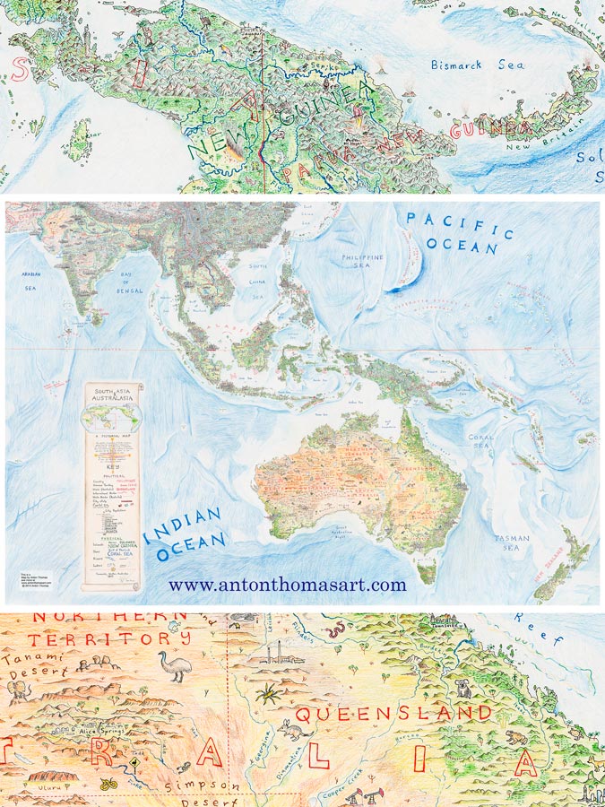 South Asia & Australasia (2013) It's 2014. I've moved to Melbourne, and I'm ready to revisit the North American continent.
 Finished all the land in May 2017, three years after starting. I felt sure the project was almost done. But the map got much more complex when I started fixing up the earliest-drawn content... Putting thousands of hours into one hand-drawn map led to vast inconsistencies, due to technical improvement that is inevitable after all that practice. I had gotten so much better that a large swathe of the early map needed to be “touched up”... as I called it at the time. Some minor fixes, lift a few faded colours, add a bit more content. But as I took my pencils and eraser down the west coast, this term "touch-up" became hilarious. The touch-ups were instantly a full-blown re-draw of a vast portion of the map. I had to work around so much old pen content (cities, rivers, borders, labels) that I developed a technique to scratch pen off with a scalpel. This allowed me to re-do any city that was not good enough. I scratched off and re-drew almost 100 cities. (More on this process in my video presentation, Methods of a Hand-Drawn Map). 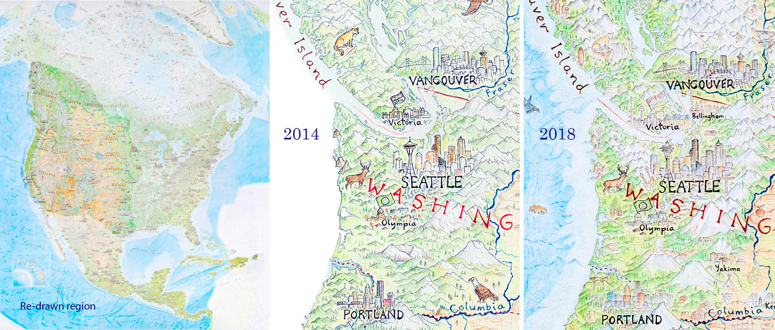 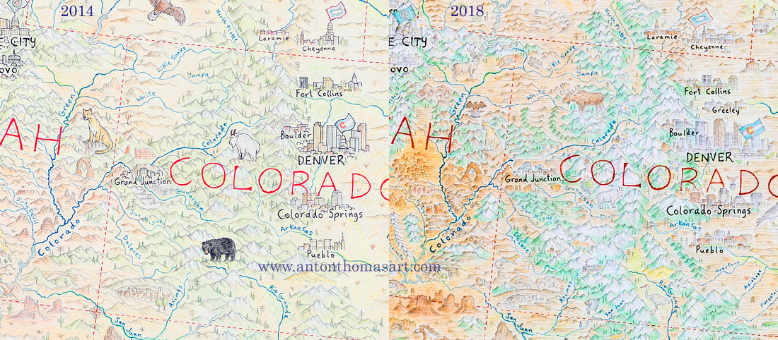 By the time I was done with the re-draw, I’d transformed the western half of the USA, and about a third of Canada. And… it was July 2018. 14 months after I began the “touch-ups”.
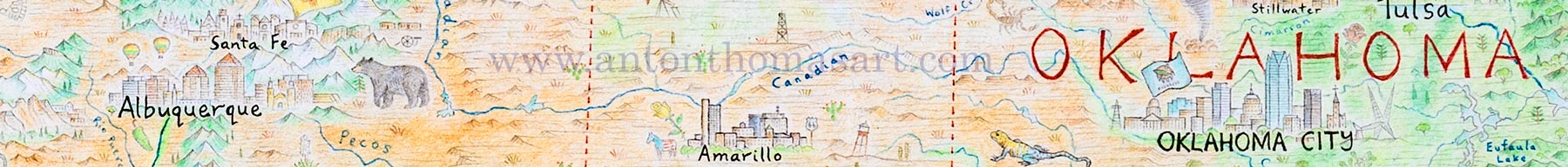
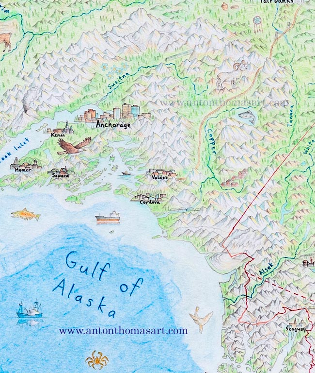
Meanwhile, I decided to include an inset map of Hawaii in the Pacific, to complete all 50 United States. While geographically it is not part of the North American continent, its role as a US state made it an easy choice to include. 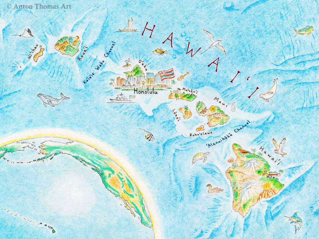 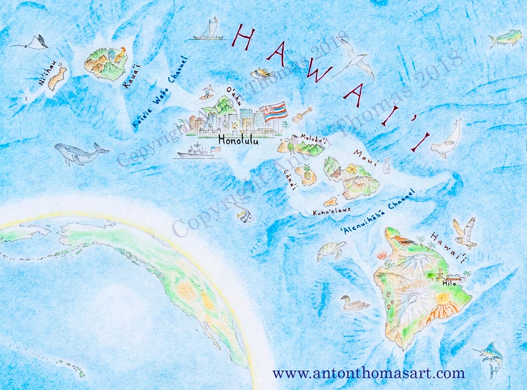
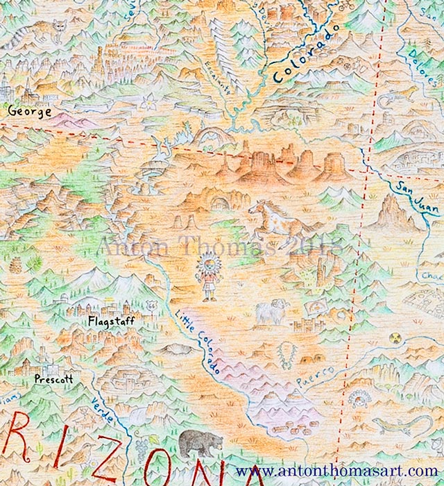
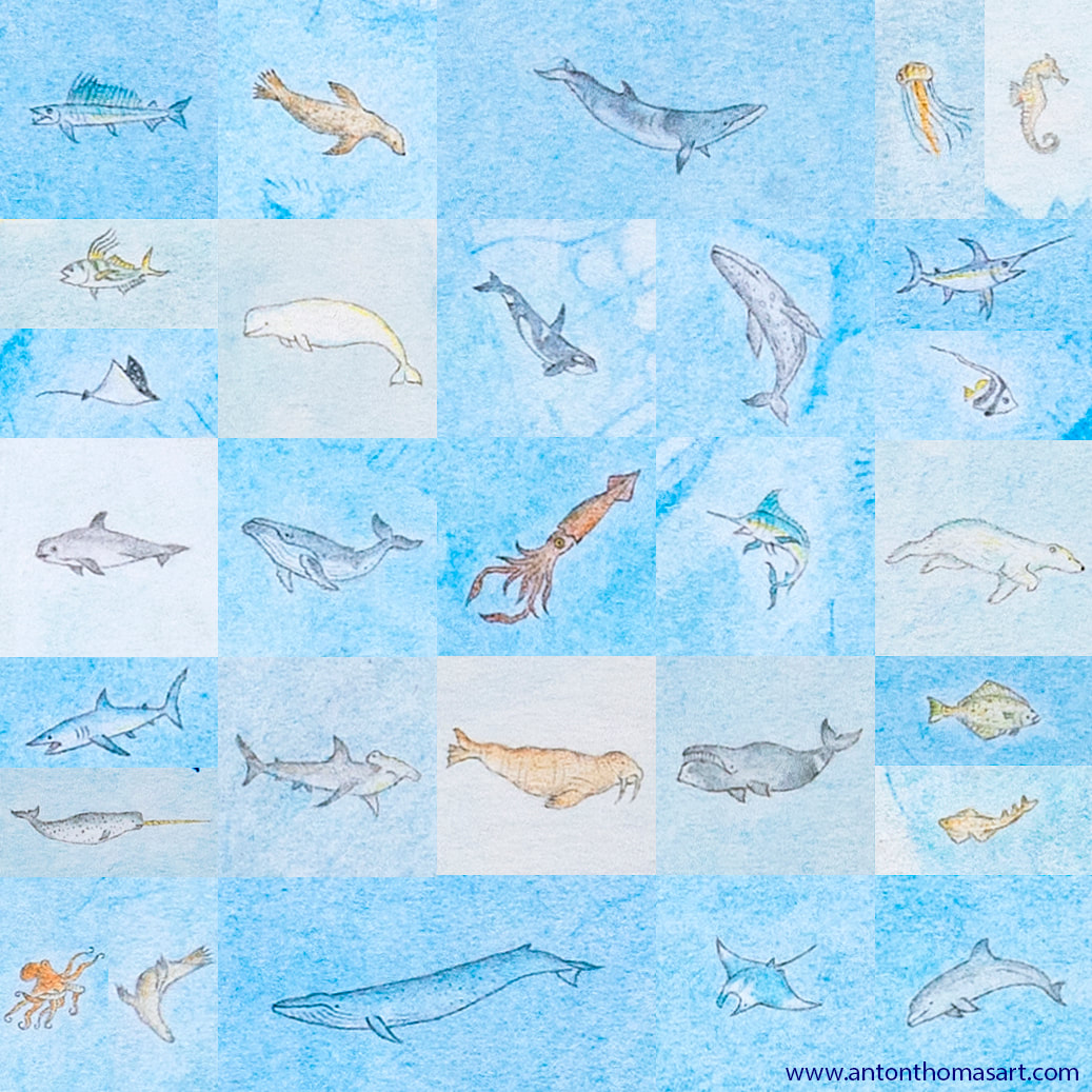
 And one final important thing. I have been so moved by all of you following my progress during the four years of this maps creation. The support, the feedback, the passion, the enthusiasm for this style of geographic art... it is amazing. I feel so blessed to have people interested in this work. Thank-you to all of you who follow it, whether on social media, in person, email... all of it. I always love to hear your feedback and ideas - many of which have influenced the map over the years. Okay, onto finishing the map! 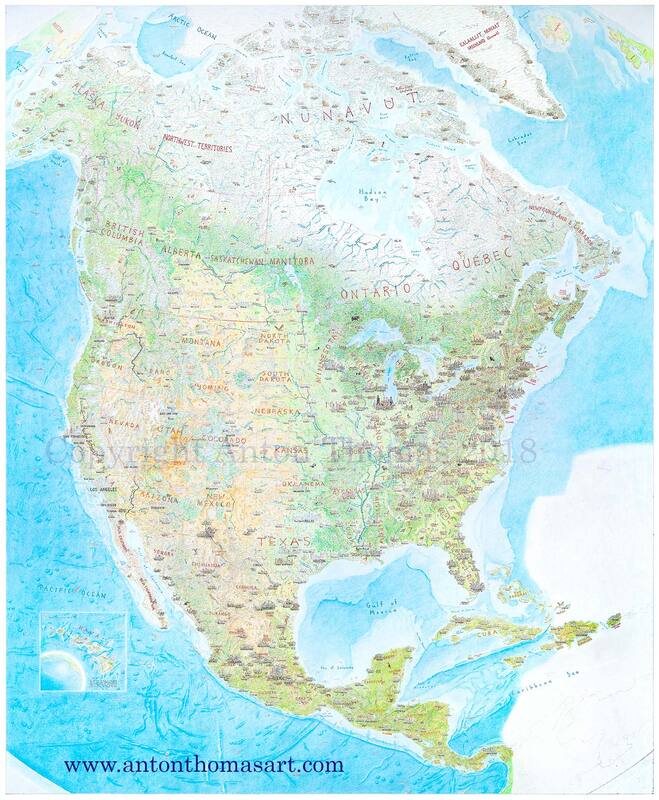 The full map, as of September 2018. All that remains is the Southeast corner (northern coast of South America, it will be without illustrated content, same as Iceland/UK and Siberia), the deepwater bathymetry and sea creatures of the Atlantic, and the title/key design which will sit in the mid-Atlantic. |
 RSS Feed
Interested in press, wholesale, or anything else? Email us at welcome@antonthomasart.com
Copyright © 2024 Anton Thomas Art. All rights Reserved.